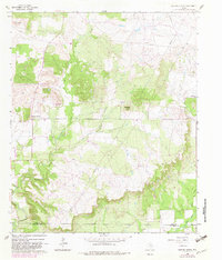
1982 Map of Bartons Chapel
USGS Topo · Published 1982About this map
Bartons Chapel serves as a central landmark in this portion of Jack County, where the landscape is defined by the dendritic drainage of the West Fork Keechi Creek and its various tributaries. This 1982 photorevised survey illustrates a rural Texas environment where traditional community markers like Springdale Ch and Bartons Chapel Cem coexist with the region's energy infrastructure, evidenced by numerous Oil Wells scattered across the north. The terrain rises to distinct elevations such as Tettertiller Hill and the survey point at VABM 1298 Steed, offering a clear view of the transition between wooded creek bottoms and open upland fields. The map also captures the local transport and aviation footprint of the era, from the winding rural roads to a remote Landing Strip located near the western boundary. For genealogists, the presence of specific family-named landmarks like Sparks Spring provides valuable localized context for the late 20th-century Jack County countryside.
Find a feature on this map
18 named features on this map. Tap any name to fly to it.
Don’t see what you’re looking for? This feature index may not catch every label — zoom into the map to look around manually.
Map Details
Editions of this 1982 Bartons Chapel Map
This is the sole edition of this map. No revisions or reprints were ever made.
Other maps of this area

1891 · Palo Pinto
USGS Topo · 1:125,000

1918 · Palo Pinto
USGS Topo · 1:125,000

1924 · Palo Pinto 2-a
USGS Topo · 1:48,000

1924 · Palo Pinto 1-b
USGS Topo · 1:48,000

1927 · Pickwick
USGS Topo · 1:62,500

1927 · Mineral Wells
USGS Topo · 1:62,500

1954 · Abilene
USGS Topo · 1:250,000

1954 · Wichita Falls
USGS Topo · 1:250,000

1958 · Wichita Falls
USGS Topo · 1:250,000

1958 · Abilene
USGS Topo · 1:250,000