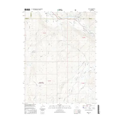
2016 Map of Basalt
USGS Topo · Published 2016About this map
The Roaring Fork River and Fryingpan River converge near the town of Basalt, creating a focal point for settlement and transportation along the valley floor. In the mid-2010s, the landscape reflects a mixture of long-standing agricultural infrastructure and modern recreation. Established irrigation systems like the Home Supply Ditch, Arbaney Ditch, and Kester Ditch continue to mark the valley, while the Rio Grande Trail follows the path of former rail transit. Smaller named locales such as Hooks, Emma, and Wingo are situated along the primary river corridor, contrasted by the steep ascent toward McCartney Mesa and the White River National Forest. Genealogists may find interest in the location of Fairview Cem on the northeastern edge of the settlement area. Higher elevations to the southwest include Dinkle Lake and the Buzzard Basin Trail, highlighting the transition from riverfront life to high-country wilderness.
Find a feature on this map
62 named features on this map. Tap any name to fly to it.
Don’t see what you’re looking for? This feature index may not catch every label — zoom into the map to look around manually.
Map Details
Editions of this 2016 Basalt Map
This is the sole edition of this map. No revisions or reprints were ever made.
Other maps of this area

1893 · Aspen
USGS Topo · 1:62,500

1895 · Aspen
USGS Topo · 1:62,500

1909 · Mount Jackson
USGS Topo · 1:125,000

1911 · Mount Jackson
USGS Topo · 1:125,000

1957 · Leadville
USGS Topo · 1:250,000

1959 · Leadville
USGS Topo · 1:250,000

1960 · Leadville
USGS Topo · 1:250,000

1960 · Highland Peak
USGS Topo · 1:24,000

1960 · Capitol Peak
USGS Topo · 1:24,000

1960 · Redstone
USGS Topo · 1:24,000