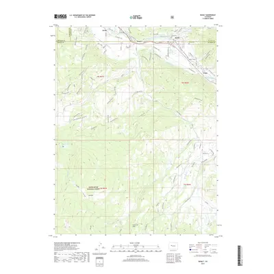
2019 Map of Basalt
USGS Topo · Published 2019About this map
The confluence of the Roaring Fork River and the Fryingpan River defines the community of Basalt, a central hub in this Rocky Mountain landscape. The river corridors serve as the primary arteries for transit and settlement, with the Rio Grande Trail following the valley floor alongside historic tracks. Northwest of the main town site, the settlements of Emma and Hooks are established along the valley floor, while Wingo sits further downstream. The geography transition from the river basins to the high country is marked by intricate water management features like the Home Supply Ditch and Arbaney Ditch.
Find a feature on this map
82 named features on this map. Tap any name to fly to it.
Don’t see what you’re looking for? This feature index may not catch every label — zoom into the map to look around manually.
Map Details
Editions of this 2019 Basalt Map
This is the sole edition of this map. No revisions or reprints were ever made.
Other maps of this area

1893 · Aspen
USGS Topo · 1:62,500

1895 · Aspen
USGS Topo · 1:62,500

1909 · Mount Jackson
USGS Topo · 1:125,000

1911 · Mount Jackson
USGS Topo · 1:125,000

1957 · Leadville
USGS Topo · 1:250,000

1959 · Leadville
USGS Topo · 1:250,000

1960 · Leadville
USGS Topo · 1:250,000

1960 · Highland Peak
USGS Topo · 1:24,000

1960 · Capitol Peak
USGS Topo · 1:24,000

1960 · Redstone
USGS Topo · 1:24,000