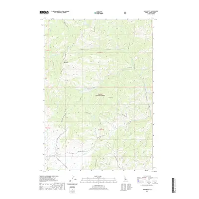
2020 Map of Basin Butte
USGS Topo · Published 2020About this map
Challis National Forest dominates this landscape in Custer County, characterized by a complex network of seasonal access routes and high-elevation landmarks. The prominence of Basin Butte and Potato Mtn serve as the primary topographical anchors, with the former featuring the Basin Butte Lookout trail. The drainage patterns are defined by the Basin Creek and Stanley Creek systems, which create distinct basins such as Little Basin and Lower Basin. Evidence of seasonal recreation and forestry management is visible through specialized routes like the Kelly Creek Loop and the Stanley Basin snow track. These trails, alongside historic mountain passages like Nip And Tuck Rd and Red Mountain Rd, illustrate the long-standing use of these Idaho highlands for both resource management and backcountry transit.
Find a feature on this map
43 named features on this map. Tap any name to fly to it.
Don’t see what you’re looking for? This feature index may not catch every label — zoom into the map to look around manually.
Map Details
Editions of this 2020 Basin Butte Map
This is the sole edition of this map. No revisions or reprints were ever made.
Other maps of this area

1891 · Bear Valley
USGS Topo · 1:125,000

1893 · Bear Valley
USGS Topo · 1:125,000

1919 · Custer
USGS Topo · 1:125,000

1922 · Custer
USGS Topo · 1:125,000

1957 · Challis
USGS Topo · 1:250,000

1960 · Challis
USGS Topo · 1:250,000

1963 · Challis
USGS Topo · 1:250,000

1963 · Stanley
USGS Topo · 1:24,000

1963 · Basin Butte
USGS Topo · 1:24,000

1963 · Casino Lakes
USGS Topo · 1:24,000