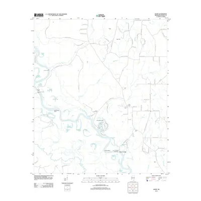
2012 Map of Basin
USGS Topo · Published 2012About this map
The Pascagoula River meanders through this portion of George County, creating a complex landscape of oxbow lakes and dead rivers like the McCrea Dead River and Woodard Dead River. This 2012 survey illustrates the river's historical importance to transport and industry, marked by the site of the Mengel Lumber Camp and the persistent crossing at Wilkerson Ferry. The riverbanks are dotted with small fishing spots such as Blue Gill Lake and Bream Lake, while the surrounding uplands like Reed Flat are crisscrossed by rural roads named for established local families.
Find a feature on this map
107 named features on this map. Tap any name to fly to it.
Don’t see what you’re looking for? This feature index may not catch every label — zoom into the map to look around manually.
Map Details
Editions of this 2012 Basin Map
This is the sole edition of this map. No revisions or reprints were ever made.
Other maps of this area

1941 · Vancleave
USGS Topo · 1:62,500

1941 · Lucedale
USGS Topo · 1:62,500

1943 · Lucedale
USGS Topo · 1:62,500

1943 · Vancleave
USGS Topo · 1:62,500

1944 · Vancleave
USGS Topo · 1:62,500

1947 · Benndale
USGS Topo · 1:62,500

1949 · Benndale
USGS Topo · 1:62,500

1953 · Mobile
USGS Topo · 1:250,000

1954 · Vestry
USGS Topo · 1:62,500

1957 · Mobile
USGS Topo · 1:250,000