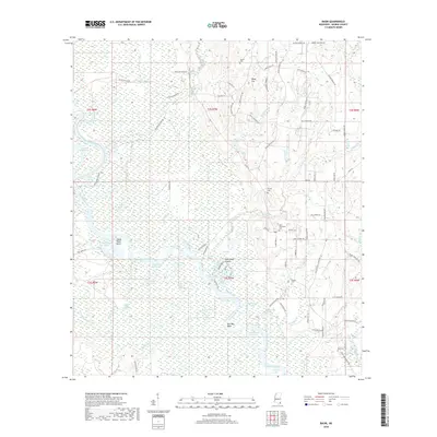
2018 Map of Basin
USGS Topo · Published 2018About this map
The Pascagoula River snakes through George County in this modern survey, defining a landscape dominated by complex hydrography and floodplains. The river's winding path has created numerous oxbows and secondary channels such as McCrea Dead River, Upper Rines Lake, and Woodard Dead River. These water bodies, along with the Plum Bluff Cutoff, illustrate the dynamic nature of the river system. On the higher ground and river bluffs, the map identifies several family cemeteries including Gibson Cem, Byrd-Helveston Cem, and Fairley Cem, providing essential points of interest for genealogists tracing local families in the Basin area.
Find a feature on this map
88 named features on this map. Tap any name to fly to it.
Don’t see what you’re looking for? This feature index may not catch every label — zoom into the map to look around manually.
Map Details
Editions of this 2018 Basin Map
This is the sole edition of this map. No revisions or reprints were ever made.
Other maps of this area

1941 · Vancleave
USGS Topo · 1:62,500

1941 · Lucedale
USGS Topo · 1:62,500

1943 · Lucedale
USGS Topo · 1:62,500

1943 · Vancleave
USGS Topo · 1:62,500

1944 · Vancleave
USGS Topo · 1:62,500

1947 · Benndale
USGS Topo · 1:62,500

1949 · Benndale
USGS Topo · 1:62,500

1953 · Mobile
USGS Topo · 1:250,000

1954 · Vestry
USGS Topo · 1:62,500

1957 · Mobile
USGS Topo · 1:250,000