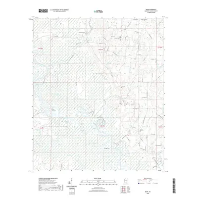
2020 Map of Basin
USGS Topo · Published 2020About this map
The Pascagoula River meanders through this portion of George County, creating a complex network of oxbow lakes and cutoffs such as Peterson Lake, Bream Lake, and Horseshoe Lake. This riverine environment is punctuated by named bends like Sandy Wash Bend and the Plum Bluff Cutoff, which illustrate the dynamic nature of the Mississippi coastal plain's waterways. The settlement of Basin serves as a local hub, surrounded by family-named roads and landmarks that reflect a deep-rooted rural community.
Find a feature on this map
100 named features on this map. Tap any name to fly to it.
Don’t see what you’re looking for? This feature index may not catch every label — zoom into the map to look around manually.
Map Details
Editions of this 2020 Basin Map
This is the sole edition of this map. No revisions or reprints were ever made.
Other maps of this area

1941 · Vancleave
USGS Topo · 1:62,500

1941 · Lucedale
USGS Topo · 1:62,500

1943 · Lucedale
USGS Topo · 1:62,500

1943 · Vancleave
USGS Topo · 1:62,500

1944 · Vancleave
USGS Topo · 1:62,500

1947 · Benndale
USGS Topo · 1:62,500

1949 · Benndale
USGS Topo · 1:62,500

1953 · Mobile
USGS Topo · 1:250,000

1954 · Vestry
USGS Topo · 1:62,500

1957 · Mobile
USGS Topo · 1:250,000