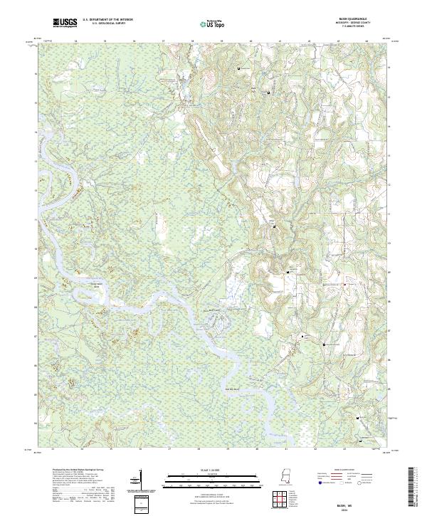
2024 Map of Basin
USGS Topo · Published 2024About this map
The Pascagoula River defines the lower-lying terrain of this George County landscape, where the river's winding course creates a complex network of secondary waterways and oxbow formations. Local history and genealogy are deeply rooted in the many family burial sites scattered across the higher ground, including the Howell Family Cem, Byrd - Helveston Cem, and Ferrill Cem. The movement of the river over time is evident in features such as the Bilbo Dead River and Woodard Dead River, while the Plum Bluff Cutoff shows more recent hydrological shifts. Inland from the riverbanks, the terrain rises toward Reed Flat and is crisscrossed by a dense network of local roads like Basin School Rd and Old Hwy 26, which connect the rural homesteads and agricultural tracts that have sustained this community for generations.
Find a feature on this map
101 named features on this map. Tap any name to fly to it.
Don’t see what you’re looking for? This feature index may not catch every label — zoom into the map to look around manually.
Map Details
Editions of this 2024 Basin Map
This is the sole edition of this map. No revisions or reprints were ever made.
Other maps of this area

1941 · Vancleave
USGS Topo · 1:62,500

1941 · Lucedale
USGS Topo · 1:62,500

1943 · Lucedale
USGS Topo · 1:62,500

1943 · Vancleave
USGS Topo · 1:62,500

1944 · Vancleave
USGS Topo · 1:62,500

1947 · Benndale
USGS Topo · 1:62,500

1949 · Benndale
USGS Topo · 1:62,500

1953 · Mobile
USGS Topo · 1:250,000

1954 · Vestry
USGS Topo · 1:62,500

1957 · Mobile
USGS Topo · 1:250,000