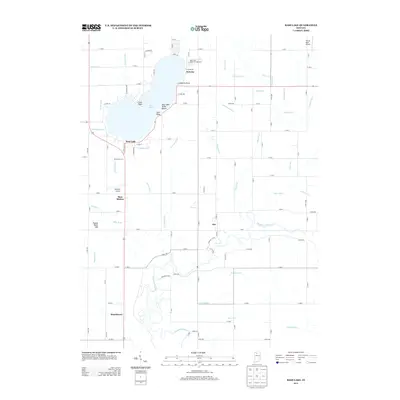
2013 Map of Bass Lake
USGS Topo · Published 2013About this map
The Bass Lake basin and the winding Tippecanoe River corridor anchor this Indiana landscape, where recreational waterfront development meets a complex system of managed waterways. Public lands such as Bass Lake State Beach and the Bass Lake State Fish Hatchery highlight the area's importance for local ecology and tourism. The surrounding terrain is heavily defined by an intricate network of drainage channels, including the Castleman Ditch, House Ditch, and Craigmile Ditch, which support the agricultural productivity of the region between the settlements of Winona and Beardstown.
Find a feature on this map
106 named features on this map. Tap any name to fly to it.
Don’t see what you’re looking for? This feature index may not catch every label — zoom into the map to look around manually.
Map Details
Editions of this 2013 Bass Lake Map
This is the sole edition of this map. No revisions or reprints were ever made.
Other maps of this area

1953 · Chicago
USGS Topo · 1:250,000

1957 · Chicago
USGS Topo · 1:250,000

1957 · Knox East
USGS Topo · 1:24,000

1957 · Knox West
USGS Topo · 1:24,000

1958 · Donaldson
USGS Topo · 1:24,000

1962 · Winamac
USGS Topo · 1:24,000

1962 · Kewanna
USGS Topo · 1:24,000

1962 · Denham
USGS Topo · 1:24,000
1962 · Ripley
USGS Topo · 1:24,000

1962 · Bass Lake
USGS Topo · 1:24,000