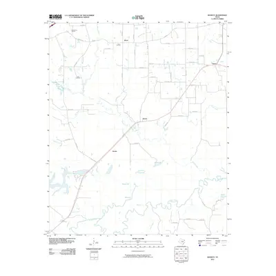
2010 Map of Bassett
USGS Topo · Published 2010About this map
The Sulphur River meanders along the southern border of this Bowie County landscape, defining a wetland environment filled with oxbows and named waters. This riparian zone is marked by Blue Lake, Mossy Lake, Calver Lake, and Mudd Lake, indicating a complex hydrological system where Crow Creek and Bassett Creek converge toward the river valley. The terrain transitions from these low-lying bottomlands to the elevated rural settlements of Bassett and Darden further north.
Find a feature on this map
55 named features on this map. Tap any name to fly to it.
Don’t see what you’re looking for? This feature index may not catch every label — zoom into the map to look around manually.
Map Details
Editions of this 2010 Bassett Map
This is the sole edition of this map. No revisions or reprints were ever made.
Other maps of this area

1909 · New Boston
USGS Topo · 1:62,500

1910 · Linden
USGS Topo · 1:62,500

1914 · Daingerfield
USGS Topo · 1:62,500

1930 · Bassett
USGS Topo · 1:62,500

1953 · Texarkana
USGS Topo · 1:250,000

1954 · New Boston
USGS Topo · 1:24,000

1955 · Corley
USGS Topo · 1:24,000

1955 · New Boston
USGS Topo · 1:62,500

1956 · Texarkana
USGS Topo · 1:250,000
1965 · Hodgson
USGS Topo · 1:24,000