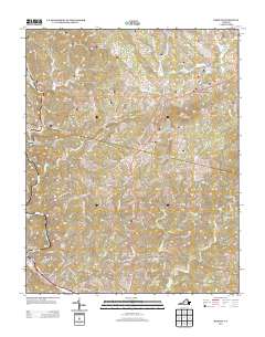
2013 Map of Bassett
USGS Topo · Published 2013About this map
Bassett and North Bassett anchor the southwestern corner of this survey, where the Smith River winds through a landscape defined by steep ridges and narrow creek valleys. This 2013 topographic study highlights the residential development patterns along the river, contrasting with the more dispersed rural settlements like Oak Level and Reed Creek Village to the north and east. The terrain is marked by significant elevations including Fork Mountain and Skelt Mountain, separated by Juggs Gap, a natural pass that has historically influenced the path of local travel. Numerous watercourses, such as Little Reed Cr and Big Chestnut Cr, carve out the hollows where much of the local road network is concentrated. The map serves as a contemporary record of the built environment in this portion of Henry County, documenting the proximity of industry and housing to the river and the various smaller communities like Henry that line the secondary roads.
Find a feature on this map
153 named features on this map. Tap any name to fly to it.
Don’t see what you’re looking for? This feature index may not catch every label — zoom into the map to look around manually.
Map Details
Editions of this 2013 Bassett Map
This is the sole edition of this map. No revisions or reprints were ever made.
Other maps of this area

1924 · Martinsville
USGS Topo · 1:48,000

1925 · Rocky Mount
USGS Topo · 1:48,000

1926 · Martinsville
USGS Topo · 1:62,500

1926 · Critz
USGS Topo · 1:48,000

1927 · Rocky Mount
USGS Topo · 1:62,500

1927 · Martinsville
USGS Topo · 1:62,500

1928 · Critz
USGS Topo · 1:62,500

1944 · Martinsville
USGS Topo · 1:62,500

1944 · Rocky Mount
USGS Topo · 1:62,500

1953 · Winston-Salem
USGS Topo · 1:250,000