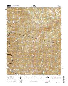
2016 Map of Bassett
USGS Topo · Published 2016About this map
Stanleytown and Collinsville anchor the southern portion of this landscape, situated along the corridor of Virginia Ave. The map reveals a dense network of family-named landmarks and cemeteries scattered through the hills north of Bassett, where names like Hurt-Thompson Cem and Lipscomb-Thornton Cem indicate deep-rooted genealogical significance. The terrain is defined by the winding course of the Smith River and the high points of Skelt Mtn and Juggs Gap.
Find a feature on this map
141 named features on this map. Tap any name to fly to it.
Don’t see what you’re looking for? This feature index may not catch every label — zoom into the map to look around manually.
Map Details
Editions of this 2016 Bassett Map
This is the sole edition of this map. No revisions or reprints were ever made.
Other maps of this area

1924 · Martinsville
USGS Topo · 1:48,000

1925 · Rocky Mount
USGS Topo · 1:48,000

1926 · Martinsville
USGS Topo · 1:62,500

1926 · Critz
USGS Topo · 1:48,000

1927 · Rocky Mount
USGS Topo · 1:62,500

1927 · Martinsville
USGS Topo · 1:62,500

1928 · Critz
USGS Topo · 1:62,500

1944 · Martinsville
USGS Topo · 1:62,500

1944 · Rocky Mount
USGS Topo · 1:62,500

1953 · Winston-Salem
USGS Topo · 1:250,000