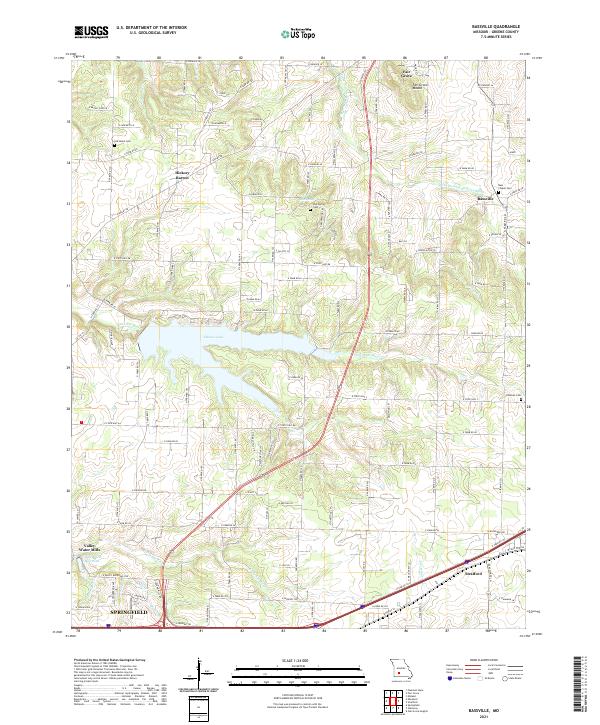
2021 Map of Bassville
USGS Topo · Published 2021About this map
Fair Grove Mound rises above the rolling landscape north of Springfield, serving as a prominent landmark in this transition between the Ozark Plateau and the plains. The northern reaches of the city extend into this area, evidenced by the development around Valley Water Mills and the Valley Water Mill Pond. The hydrology is defined by the headwaters of several systems, including the Little Pomme de Terre River, the S Dry Sac River, and the Little Sac River, which feeds into the large expanse of Fellows Lake. Genealogists will find several notable burial sites scattered across the rural landscape, such as Old Salem Cem, Elm Spring Cem, and Bass Chapel Cem. Smaller settlements like Hickory Barren and Bassville maintain their distinct identities even as the regional infrastructure of Greene County modernizes.
Find a feature on this map
109 named features on this map. Tap any name to fly to it.
Don’t see what you’re looking for? This feature index may not catch every label — zoom into the map to look around manually.
Map Details
Editions of this 2021 Bassville Map
This is the sole edition of this map. No revisions or reprints were ever made.
Other maps of this area

1884 · Springfield
USGS Topo · 1:125,000

1886 · Springfield
USGS Topo · 1:125,000

1935 · Springfield
USGS Topo · 1:24,000

1937 · Galloway
USGS Topo · 1:24,000

1937 · Ozark
USGS Topo · 1:48,000

1943 · Ozark
USGS Topo · 1:62,500

1945 · Ozark
USGS Topo · 1:62,500

1946 · Bassville
USGS Topo · 1:24,000

1947 · Strafford
USGS Topo · 1:62,500

1948 · Bassville
USGS Topo · 1:24,000