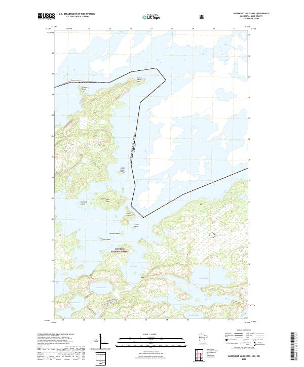
2022 Map of Basswood Lake East
USGS Topo · Published 2022About this map
The international border between the United States of America and Canada runs through the heart of the Boundary Waters within the Superior National Forest. This aquatic landscape is defined by its complex network of interconnected waterways and storied islands, including Hausons Island, Washington Island, and the specifically named Indian Grave Island. The map details a primitive transportation network of portages and seasonal paths, such as the Indiana-Good Trl and the specialized Hula-Wind Bay Winter Trl. Prominent points of interest for navigation include United States Point and several distinct bays like Hoist Bay and Wind Bay. The interior is dotted with numerous smaller bodies of water, including Indiana Lake, Washte Lake, and Acorn Lake, illustrating the dense, lakeland character of northern Lake County.
Find a feature on this map
25 named features on this map. Tap any name to fly to it.
Don’t see what you’re looking for? This feature index may not catch every label — zoom into the map to look around manually.
Map Details
Editions of this 2022 Basswood Lake East Map
This is the sole edition of this map. No revisions or reprints were ever made.
Other maps of this area

1954 · Two Harbors
USGS Topo · 1:250,000

1957 · Two Harbors
USGS Topo · 1:250,000

1957 · Gabbro Lake
USGS Topo · 1:62,500

1957 · Ensign Lake
USGS Topo · 1:62,500

1957 · Basswood Lake
USGS Topo · 1:62,500

1957 · Quetico
USGS Topo · 1:250,000

1958 · Two Harbors
USGS Topo · 1:250,000

1964 · Two Harbors
USGS Topo · 1:250,000

1968 · Quetico
USGS Topo · 1:250,000
1976 · Basswood Lake SW
USGS Topo · 1:24,000