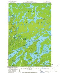
1957 Map of Basswood Lake
USGS Topo · Published 1963About this map
Quetico Provincial Park dominates this mid-century survey of the international border between Lake County and Ontario. The intricate water network of the Boundary Waters is documented here during a period of active conservation and scientific interest, highlighted by the Quetico Wilderness Research Center on the shores of Basswood Lake. The map illustrates a landscape shaped by glacial action, featuring massive landforms like Hunter Island and a labyrinth of bays including Thursday Bay and Wednesday Bay. Evidence of human activity is sparse but significant, centered around a historic Trading Post and a Gaging Station used for hydrological monitoring. The placement of a Cem on Washington Island points to early island settlement or long-standing regional presence before the area became more strictly regulated as wilderness.
Find a feature on this map
90 named features on this map. Tap any name to fly to it.
Don’t see what you’re looking for? This feature index may not catch every label — zoom into the map to look around manually.
Map Details
Editions of this 1957 Basswood Lake Map
3 editions found
Other maps of this area

1933 · Ely
USGS Topo · 1:62,500

1939 · Ely
USGS Topo · 1:62,500

1954 · Two Harbors
USGS Topo · 1:250,000

1957 · Two Harbors
USGS Topo · 1:250,000

1957 · Gabbro Lake
USGS Topo · 1:62,500

1957 · Ensign Lake
USGS Topo · 1:62,500

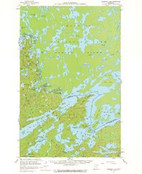
1957 · Basswood Lake
USGS Topo · 1:62,500

1957 · Quetico
USGS Topo · 1:250,000

1958 · Two Harbors
USGS Topo · 1:250,000

1963 · Fourtown Lake
USGS Topo · 1:24,000