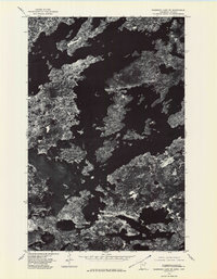
1976 Map of Basswood Lake SE
USGS Topo · Published 1979About this map
Basswood Lake dominates this aerial perspective of the Superior National Forest boundary waters, where the United States Canada border threads through a complex archipelago. This 1976 orthophotograph, produced by the Geological Survey, captures the dense boreal forest and crystalline water patterns before modern digital imaging. Large reaches like Wind Bay and Ranger Bay reveal the jagged shoreline of the Quetico-Superior wilderness, while Hoist Bay marks a distinct finger of water in the south. The imagery provides a clear view of the Ontario Minnesota international line, showing the remote character of this glaciated landscape where land and water are intricately intertwined.
Find a feature on this map
6 named features on this map. Tap any name to fly to it.
Don’t see what you’re looking for? This feature index may not catch every label — zoom into the map to look around manually.
Map Details
Editions of this 1976 Basswood Lake SE Map
This is the sole edition of this map. No revisions or reprints were ever made.
Other maps of this area

1954 · Two Harbors
USGS Topo · 1:250,000

1957 · Two Harbors
USGS Topo · 1:250,000

1957 · Gabbro Lake
USGS Topo · 1:62,500

1957 · Ensign Lake
USGS Topo · 1:62,500

1957 · Basswood Lake
USGS Topo · 1:62,500

1957 · Quetico
USGS Topo · 1:250,000

1958 · Two Harbors
USGS Topo · 1:250,000

1964 · Two Harbors
USGS Topo · 1:250,000

1968 · Quetico
USGS Topo · 1:250,000
1976 · Basswood Lake SW
USGS Topo · 1:24,000