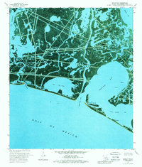
1973 Map of Bastian Bay
USGS Topo · Published 1989About this map
Bastian Bay and the surrounding marshlands of Plaquemines Parish appear here as a complex network of wetlands and industrial infrastructure in the early 1970s. This orthophotomap, derived from 1971 aerial photography, reveals the intensive footprint of energy extraction within the coastal landscape. A widespread Oil and Gas Field dominates the interior, crisscrossed by numerous pipelines and dotted with features like a Gas Well and a Drill Hole.
Find a feature on this map
32 named features on this map. Tap any name to fly to it.
Don’t see what you’re looking for? This feature index may not catch every label — zoom into the map to look around manually.
Map Details
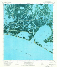
Editions of this 1973 Bastian Bay Map
2 editions found
Other maps of this area

1892 · Quarantine
USGS Topo · 1:62,500

1893 · Fort Livingston
USGS Topo · 1:62,500

1935 · Port Sulphur
USGS Topo · 1:31,680

1935 · Bastian Bay
USGS Topo · 1:31,680

1935 · Bay Ronquille
USGS Topo · 1:31,680

1935 · Tropical Bend
USGS Topo · 1:31,680

1941 · Empire
USGS Topo · 1:62,500

1944 · Empire
USGS Topo · 1:62,500

1947 · Buras
USGS Topo · 1:31,680

1947 · Bay Ronquille
USGS Topo · 1:31,680