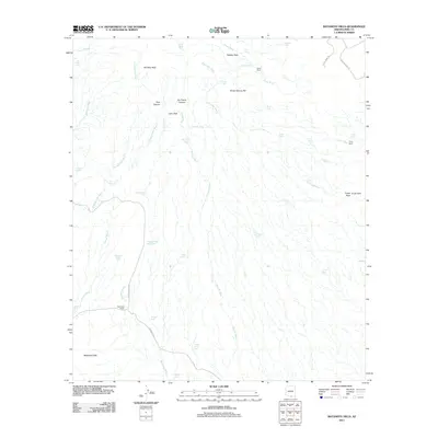
2011 Map of Batamote Hills
USGS Topo · Published 2011About this map
Batamote Hills anchor this desert landscape in Pima County, where cattle ranching and mineral exploration define the terrain. The presence of Harris Ranch and Tinaja Ranch, alongside numerous livestock watering points like Adobe House Tank and Mesquite Tanks, illustrates the persistent efforts to manage water in an arid environment. The map details a complex network of ephemeral drainages, most notably Batamote Wash, Escondido Wash, and Proctor Wash, which carve through the foothills of Red Boy Peak and Lobo Peak. Historical access to the region is marked by unpaved corridors such as San Juan Ranch Rd and Batamote Rd, while the proximity of mining activity is signaled by Duvall Mine Rd in the northeastern corner. This topography reveals a workspace where land use is dictated by the availability of seasonal water and the underlying geology of the Altar Valley region.
Find a feature on this map
48 named features on this map. Tap any name to fly to it.
Don’t see what you’re looking for? This feature index may not catch every label — zoom into the map to look around manually.
Map Details
Editions of this 2011 Batamote Hills Map
This is the sole edition of this map. No revisions or reprints were ever made.
Other maps of this area

1920 · Arivaca
USGS Topo · 1:125,000

1925 · Samaniego Peak
USGS Topo · 1:62,500

1939 · Twin Buttes
USGS Topo · 1:62,500

1939 · Tubac
USGS Topo · 1:62,500

1940 · Palo Alto Ranch
USGS Topo · 1:62,500

1941 · Twin Buttes
USGS Topo · 1:62,500

1941 · Arivaca
USGS Topo · 1:62,500

1943 · Arivaca
USGS Topo · 1:62,500

1943 · Palo Alto Ranch
USGS Topo · 1:62,500

1943 · Tubac
USGS Topo · 1:62,500