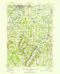
1950 Map of Batavia
USGS Topo · Published 1950About this map
Tonawanda Creek and Oatka Creek carve through the landscape of Genesee and Wyoming Counties, anchoring a region defined by its mid-century transit and agricultural networks. The city of Batavia serves as a major hub, where the New York Central RR and Lehigh Valley RR converge near the Fairgrounds and Radio Tower WBTA. This era shows the early footprint of the New York State Thruway cutting across the northern reaches, signaling a shift in New York's transportation geography.
Find a feature on this map
102 named features on this map. Tap any name to fly to it.
Don’t see what you’re looking for? This feature index may not catch every label — zoom into the map to look around manually.
Map Details
Editions of this 1950 Batavia Map
This is the sole edition of this map. No revisions or reprints were ever made.
Other maps of this area

1897 · Albion
USGS Topo · 1:62,500

1897 · Medina
USGS Topo · 1:62,500

1899 · Brockport
USGS Topo · 1:62,500

1904 · Batavia
USGS Topo · 1:62,500

1904 · Caledonia
USGS Topo · 1:62,500

1905 · Attica
USGS Topo · 1:62,500

1905 · Portage
USGS Topo · 1:62,500

1905 · Nunda
USGS Topo · 1:62,500

1923 · Arcade
USGS Topo · 1:62,500

1925 · Arcade
USGS Topo · 1:62,500