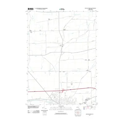
2010 Map of Batavia North
USGS Topo · Published 2010About this map
Batavia Downs and the northern reaches of the city anchor the southern portion of this landscape, where industrial development and transportation corridors meet the agricultural fields of Genesee County. The area is defined by a series of small, historic hamlets and crossroads such as Elba, East Oakfield, and Langton Corners. The terrain is shaped by the subtle rise of Bulgary Ridge and the winding paths of Oak Orchard Creek and Tonawanda Creek. Numerous family and community burial grounds, including Gardner Cemetery and Pine Hill Cemetery, are scattered across the quadrangle, reflecting generations of local settlement. The presence of the Genesee County Airport and the complex road network, including the Batavia Elba Townline Rd, illustrates the transition from a traditional farming economy to a modern regional hub.
Find a feature on this map
53 named features on this map. Tap any name to fly to it.
Don’t see what you’re looking for? This feature index may not catch every label — zoom into the map to look around manually.
Map Details
Editions of this 2010 Batavia North Map
This is the sole edition of this map. No revisions or reprints were ever made.
Other maps of this area

1897 · Albion
USGS Topo · 1:62,500

1897 · Medina
USGS Topo · 1:62,500

1904 · Batavia
USGS Topo · 1:62,500

1905 · Attica
USGS Topo · 1:62,500

1944 · Alexander
USGS Topo · 1:31,680

1944 · Holley
USGS Topo · 1:31,680

1944 · Byron
USGS Topo · 1:31,680

1944 · Stafford
USGS Topo · 1:31,680

1944 · Albion
USGS Topo · 1:31,680

1949 · Attica
USGS Topo · 1:62,500