2022 Map of Batavia
USGS Topo · Published 2022About this map
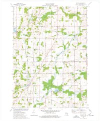
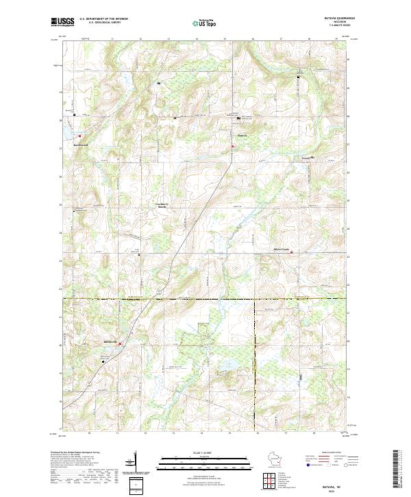
The North Branch Milwaukee River and its numerous tributaries, including Melius Cr and Batavia Cr, define the drainage and settlement patterns of this glacial landscape. Small communities like Batavia, Silver Creek, and Beechwood are situated at key intersections and water crossings, reflecting a classic Midwestern rural development model. The presence of the Gooseville Millpond on Gooseville Cr suggests a history of water-powered industry, while the naming of Indian Mound Rd in the northeast hints at even older cultural layers.
Find a feature on this map
80 named features on this map. Tap any name to fly to it.
Don’t see what you’re looking for? This feature index may not catch every label — zoom into the map to look around manually.
Map Details
Editions of this 2022 Batavia Map
This is the sole edition of this map. No revisions or reprints were ever made.