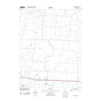
2012 Map of Bates City
USGS Topo · Published 2012About this map
The Missouri landscape east of Oak Grove is defined by the winding course of Sni-A-Bar Creek and its many tributaries, including East Fork Sni-A-Bar Creek and Shumate Branch. In 2012, this area near Bates City shows a complex network of rural and suburban infrastructure, from the Harry S Truman Regional Airport to historical pathways like the Old Santa Fe Trl. Local genealogy and land use are preserved through several burial grounds, such as Anderson Cemetery, Pleasant Prairie Cemetery, and the Campbell Cemetery on the eastern edge. Numerous small reservoirs and lakes, including Holiday Lake, Twentes Lake, and several named Lafayette County Lakes, punctuate the terrain. This sheet illustrates the modern expansion of communities along the Interstate 70 corridor while maintaining clear markers of the region's agricultural and historical roots.
Find a feature on this map
74 named features on this map. Tap any name to fly to it.
Don’t see what you’re looking for? This feature index may not catch every label — zoom into the map to look around manually.
Map Details
Editions of this 2012 Bates City Map
This is the sole edition of this map. No revisions or reprints were ever made.
Other maps of this area

1885 · Warrensburg
USGS Topo · 1:125,000

1887 · Harrisonville
USGS Topo · 1:125,000

1887 · Warrensburg
USGS Topo · 1:125,000

1889 · Lexington
USGS Topo · 1:125,000

1892 · Harrisonville
USGS Topo · 1:125,000

1894 · Harrisonville
USGS Topo · 1:125,000

1894 · Independence
USGS Topo · 1:125,000

1894 · Warrensburg
USGS Topo · 1:125,000

1934 · Oak Grove
USGS Topo · 1:24,000

1935 · Buckner
USGS Topo · 1:24,000