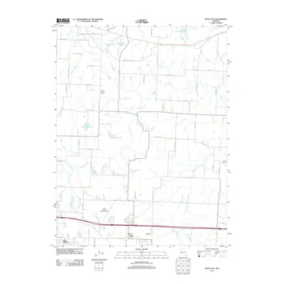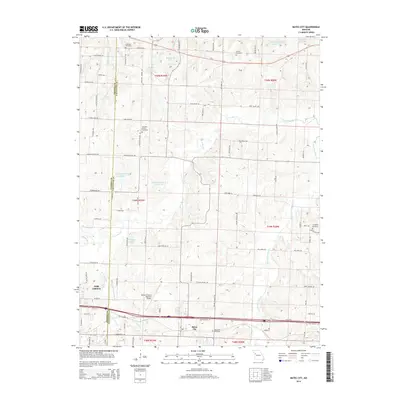
2021 Map of Bates City
USGS Topo · Published 2021About this map
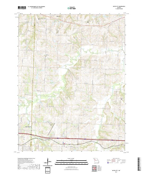
Bates City and the expanding eastern edge of Oak Grove anchor this modern survey of the Missouri landscape along the Jackson and Lafayette County border. The terrain is defined by the winding course of Sni-A-Bar Creek and its many tributaries, including Horseshoe Creek and Owl Creek, which feed a series of reservoirs like Lafayette County Lake J-21 and Holiday Lake. Historically significant burial grounds such as Anderson Cemetery and Pleasant Prairie Cemetery are preserved amidst a network of rural roads and modern transit corridors. The presence of the Harry S Truman Regional Airport and the concentrated infrastructure near Napoleon reflect the transition from agricultural land to a more developed regional hub, while the numerous small lakes and named branches suggest the importance of local water management in this part of Missouri.
Find a feature on this map
82 named features on this map. Tap any name to fly to it.
Don’t see what you’re looking for? This feature index may not catch every label — zoom into the map to look around manually.
Map Details
Editions of this 2021 Bates City Map
This is the sole edition of this map. No revisions or reprints were ever made.
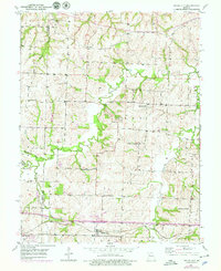
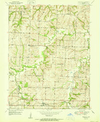
Historical Maps of Oak Grove Through Time
6 maps found