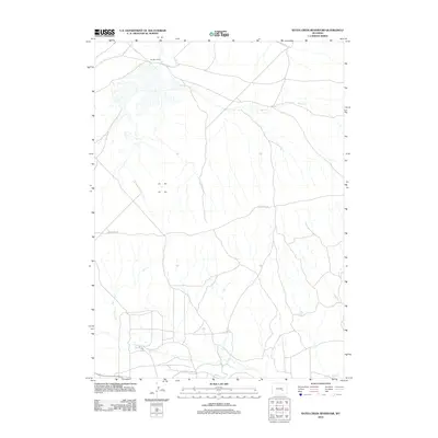
2012 Map of Bates Creek Reservoir
USGS Topo · Published 2012About this map
Two Bar Camp and the winding course of Bates Cr anchor this high-plains landscape in Natrona County during the early 21st century. The map reveals a specialized transportation network essential to local industry and ranching, most notably the Utah Mining Camp Spur and several graded routes like Bates Creek Rd and Shirley Ridge Rd. Water management in this semi-arid region is represented by the Percy Reservoir and numerous ephemeral drainage patterns including Spring Cr and Squaw Cr. These features indicate a landscape shaped by both natural riparian corridors and the infrastructure required for mineral extraction and livestock operations.
Find a feature on this map
8 named features on this map. Tap any name to fly to it.
Don’t see what you’re looking for? This feature index may not catch every label — zoom into the map to look around manually.
Map Details
Editions of this 2012 Bates Creek Reservoir Map
This is the sole edition of this map. No revisions or reprints were ever made.
Other maps of this area

1955 · Casper
USGS Topo · 1:250,000

1958 · Casper
USGS Topo · 1:250,000

1959 · Moss Agate Reservoir
USGS Topo · 1:24,000

1959 · Squaw Spring
USGS Topo · 1:24,000

1959 · Chalk Hills
USGS Topo · 1:24,000

1959 · Bates Creek Reservoir
USGS Topo · 1:24,000

1960 · Sheep Creek
USGS Topo · 1:24,000

1960 · Mud Springs
USGS Topo · 1:24,000

1960 · Measel Spring Reservoir
USGS Topo · 1:24,000

1960 · Ice Cave Mountain
USGS Topo · 1:24,000