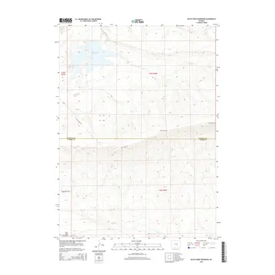
2015 Map of Bates Creek Reservoir
USGS Topo · Published 2015About this map
Bates Creek Reservoir dominates the northern terrain of this high-altitude landscape where Natrona and Carbon Counties meet. This 2015 survey reveals a classic Wyoming livestock and ranching environment defined by critical water sources and rugged relief. The drainage system is anchored by Bates Creek, with Spring Creek and Squaw Creek cutting through the southern townships. To the southwest, the prominent Moss Agate Ridge overlooks the junction of several rural routes including CR-4 and CR-2. The map illustrates a remote infrastructure where Bates Creek Road provides the primary passage through these expansive townships. This modern topographic record is essential for understanding the contemporary hydrological management and land boundaries in a region where water rights and public land access remain central to local geography.
Find a feature on this map
14 named features on this map. Tap any name to fly to it.
Don’t see what you’re looking for? This feature index may not catch every label — zoom into the map to look around manually.
Map Details
Editions of this 2015 Bates Creek Reservoir Map
This is the sole edition of this map. No revisions or reprints were ever made.
Other maps of this area

1955 · Casper
USGS Topo · 1:250,000

1958 · Casper
USGS Topo · 1:250,000

1959 · Moss Agate Reservoir
USGS Topo · 1:24,000

1959 · Squaw Spring
USGS Topo · 1:24,000

1959 · Chalk Hills
USGS Topo · 1:24,000

1959 · Bates Creek Reservoir
USGS Topo · 1:24,000

1960 · Sheep Creek
USGS Topo · 1:24,000

1960 · Mud Springs
USGS Topo · 1:24,000

1960 · Measel Spring Reservoir
USGS Topo · 1:24,000

1960 · Ice Cave Mountain
USGS Topo · 1:24,000