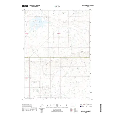
2018 Map of Bates Creek Reservoir
USGS Topo · Published 2018About this map
Bates Creek Reservoir dominates the high-country landscape of the border between Natrona and Carbon counties. This high-altitude drainage basin, mapped by the U.S. Geological Survey in 2018, is defined by the convergence of Bates Cr and Spring Cr, with waters collected at both the primary reservoir and the smaller Percy Reservoir to the southwest. The terrain is marked by the prominent Moss Agate Ridge, which provides a geological anchor for the western portion of the sheet. Modern access via Bates Creek Rd follows the historical route of the Old Casper Medicine Bow Hwy, illustrating the long-standing importance of this corridor for travel across the Wyoming interior. Further south, the Utah Mining Camp Spr road hints at the region's historical extractive industry, connecting the remote hills and seasonal creek beds like Squaw Cr to established transportation networks.
Find a feature on this map
17 named features on this map. Tap any name to fly to it.
Don’t see what you’re looking for? This feature index may not catch every label — zoom into the map to look around manually.
Map Details
Editions of this 2018 Bates Creek Reservoir Map
This is the sole edition of this map. No revisions or reprints were ever made.
Other maps of this area

1955 · Casper
USGS Topo · 1:250,000

1958 · Casper
USGS Topo · 1:250,000

1959 · Moss Agate Reservoir
USGS Topo · 1:24,000

1959 · Squaw Spring
USGS Topo · 1:24,000

1959 · Chalk Hills
USGS Topo · 1:24,000

1959 · Bates Creek Reservoir
USGS Topo · 1:24,000

1960 · Sheep Creek
USGS Topo · 1:24,000

1960 · Mud Springs
USGS Topo · 1:24,000

1960 · Measel Spring Reservoir
USGS Topo · 1:24,000

1960 · Ice Cave Mountain
USGS Topo · 1:24,000