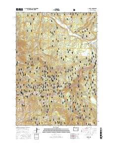
2017 Map of Bates
USGS Topo · Published 2017About this map
The Middle Fork John Day River winds through the northern portion of this landscape, set within the expanse of the Malheur National Forest. This 2017 study illustrates the remote character of the area around the small settlement of Bates, where Bates Pond sits near the junction of Bridge Cr and Vinegar Cr. The terrain is defined by dramatic elevation changes, rising toward the peaks of Dixie Butte and the mountain pass at Dixie Summit. An extensive network of forest roads, including Natl Forest Develop Road 2612 RD, provides access to the backcountry. Notable landmarks such as Placer Gulch and Dead Cow Gulch point to the area's history of prospecting and ranching, while numerous drainages like Jeff Davis Cr and George Cr feed the larger river system in this corner of Grant County.
Find a feature on this map
34 named features on this map. Tap any name to fly to it.
Don’t see what you’re looking for? This feature index may not catch every label — zoom into the map to look around manually.
Map Details
Editions of this 2017 Bates Map
This is the sole edition of this map. No revisions or reprints were ever made.
Other maps of this area

1901 · Sumpter
USGS Topo · 1:125,000

1908 · Ironside Mountain
USGS Topo · 1:125,000

1951 · Bates
USGS Topo · 1:62,500

1955 · Canyon City
USGS Topo · 1:250,000

1959 · Canyon City
USGS Topo · 1:250,000

1959 · Prairie City
USGS Topo · 1:62,500

1972 · Austin
USGS Topo · 1:24,000
1972 · Deardorff Mtn
USGS Topo · 1:24,000

1972 · Greenhorn
USGS Topo · 1:24,000

1978 · John Day
USGS Topo · 1:100,000