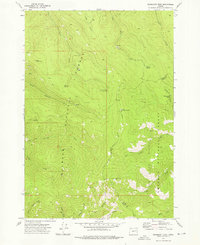
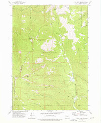
1972 Map of Deardorff Mtn
USGS Topo · Published 1976About this map
Malheur National Forest and Whitman National Forest converge in this high-altitude landscape of the Blue Mountains, where the boundary between Grant and Baker counties follows the primary ridges. The terrain is defined by steep drainages like Reynolds Creek and Clear Creek, which flow through a network of named gulches and forks. High points such as Deardorff Mtn and Baldy Mtn anchor the topography, while a lone Elkhorn Microwave Station stands as a modern landmark amidst the wilderness.
Find a feature on this map
33 named features on this map. Tap any name to fly to it.
Don’t see what you’re looking for? This feature index may not catch every label — zoom into the map to look around manually.
Map Details
Editions of this 1972 Deardorff Mtn Map
2 editions found
Other maps of this area

1901 · Sumpter
USGS Topo · 1:125,000

1908 · Ironside Mountain
USGS Topo · 1:125,000

1951 · Bates
USGS Topo · 1:62,500

1955 · Canyon City
USGS Topo · 1:250,000

1959 · Canyon City
USGS Topo · 1:250,000

1959 · Prairie City
USGS Topo · 1:62,500

1972 · Austin
USGS Topo · 1:24,000
1972 · Bullrun Rock
USGS Topo · 1:24,000
1972 · Rail Gulch
USGS Topo · 1:24,000
1972 · Little Baldy Mnt.
USGS Topo · 1:24,000