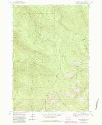
1972 Map of Deardorff Mtn
USGS Topo · Published 1984About this map
The Malheur National Forest and Whitman National Forest converge at the boundary of Grant and Baker counties in this high-elevation landscape. Dominating the topography are Deardorff Mtn and Baldy Mtn, surrounded by a complex system of drainage gulches and springs that support the local ecosystem. The presence of the Elkhorn Microwave Station atop a ridge highlights the area's role in regional communication infrastructure during the early 1970s.
Find a feature on this map
31 named features on this map. Tap any name to fly to it.
Don’t see what you’re looking for? This feature index may not catch every label — zoom into the map to look around manually.
Map Details
Editions of this 1972 Deardorff Mtn Map
2 editions found
Other maps of this area

1901 · Sumpter
USGS Topo · 1:125,000

1908 · Ironside Mountain
USGS Topo · 1:125,000

1951 · Bates
USGS Topo · 1:62,500

1955 · Canyon City
USGS Topo · 1:250,000

1959 · Canyon City
USGS Topo · 1:250,000

1959 · Prairie City
USGS Topo · 1:62,500

1972 · Austin
USGS Topo · 1:24,000
1972 · Deardorff Mtn
USGS Topo · 1:24,000
1972 · Bullrun Rock
USGS Topo · 1:24,000
1972 · Rail Gulch
USGS Topo · 1:24,000