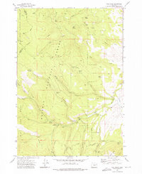
1972 Map of Rail Gulch
USGS Topo · Published 1976About this map
The South Fork Burnt River carves through the high timberlands of eastern Oregon, serving as a focal point for recreation and resource management in the early 1970s. This survey captures a landscape defined by its dual identity as a working forest and a wilderness retreat, where the boundaries of the Malheur National Forest and Whitman National Forest converge. Traces of industrial history are evident at the Bullrun Mine and Orion Mine along Mine Ridge, while the established Elk Creek Campground and South Fork Campground suggest the area's importance to outdoor enthusiasts.
Find a feature on this map
83 named features on this map. Tap any name to fly to it.
Don’t see what you’re looking for? This feature index may not catch every label — zoom into the map to look around manually.
Map Details
Editions of this 1972 Rail Gulch Map
2 editions found
Other maps of this area

1901 · Sumpter
USGS Topo · 1:125,000

1908 · Ironside Mountain
USGS Topo · 1:125,000

1955 · Canyon City
USGS Topo · 1:250,000

1959 · Canyon City
USGS Topo · 1:250,000

1972 · Austin
USGS Topo · 1:24,000
1972 · Unity
USGS Topo · 1:24,000
1972 · Deardorff Mtn
USGS Topo · 1:24,000
1972 · Bullrun Rock
USGS Topo · 1:24,000
1972 · Unity Reservoir
USGS Topo · 1:24,000
1972 · Rastus Mtn
USGS Topo · 1:24,000