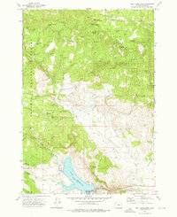
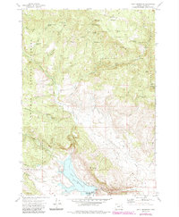
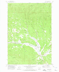
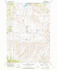
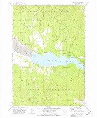
1972 Map of Unity Reservoir
USGS Topo · Published 1976About this map
Unity Reservoir dominates the southern landscape of this Baker County quadrangle, where the Burnt River and its various forks converge. The 1970s terrain is defined by the sharp transition from the irrigated valley floors and the waters of the reservoir to the high timbered slopes of the Whitman National Forest. Evidence of early industry and water management persists through labels like Martins Mill and the extensive network of irrigation infrastructure including the Ditch systems and a Siphon near the river banks. Along the Dooley Highway, the landscape reflects a mix of ranching life at the King Ranch and public recreation at the Unity Lake State Park campground. Small family-scale details, such as the lonely Cem on a ridge overlooking Pine Creek, provide essential clues for genealogists tracking early settlers in this high-desert mountain region.
Find a feature on this map
51 named features on this map. Tap any name to fly to it.
Don’t see what you’re looking for? This feature index may not catch every label — zoom into the map to look around manually.
Map Details
Editions of this 1972 Unity Reservoir Map
2 editions found
Other maps of this area

1901 · Sumpter
USGS Topo · 1:125,000

1908 · Ironside Mountain
USGS Topo · 1:125,000

1955 · Canyon City
USGS Topo · 1:250,000

1959 · Canyon City
USGS Topo · 1:250,000
1961 · Whitney
USGS Topo · 1:24,000

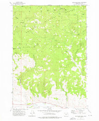
1972 · Hereford
USGS Topo · 1:24,000
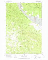
1972 · Unity
USGS Topo · 1:24,000
1972 · Phillips Lake
USGS Topo · 1:24,000
1972 · Sumpter
USGS Topo · 1:24,000
1972 · Beaverdam Creek
USGS Topo · 1:24,000