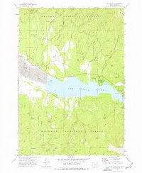
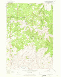
1972 Map of Phillips Lake
USGS Topo · Published 1976About this map
Phillips Lake dominates this 1970s landscape, serving as a focal point for recreation and water management in the Sumpter Valley. Along its northwestern shore, the settlement of McEwen sits adjacent to extensive Dredge Tailings, a physical reminder of the heavy industrial mining that once reshaped the Powder River bottomlands. Evidence of historical infrastructure is scattered throughout, including the Sumpter Valley Railroad Grade and the Farmers Ditch, tracing the evolution of transport and irrigation in Baker County.
Find a feature on this map
48 named features on this map. Tap any name to fly to it.
Don’t see what you’re looking for? This feature index may not catch every label — zoom into the map to look around manually.
Map Details
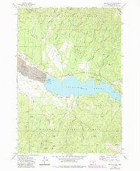
Editions of this 1972 Phillips Lake Map
2 editions found
Other maps of this area

1901 · Baker City
USGS Topo · 1:125,000

1901 · Sumpter
USGS Topo · 1:125,000

1955 · Baker
USGS Topo · 1:250,000

1955 · Canyon City
USGS Topo · 1:250,000

1959 · Baker
USGS Topo · 1:250,000

1959 · Canyon City
USGS Topo · 1:250,000
1967 · Blue Canyon
USGS Topo · 1:24,000
1967 · Wingville
USGS Topo · 1:24,000
1967 · Brannan Gulch
USGS Topo · 1:24,000
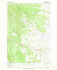
1972 · Elkhorn Peak
USGS Topo · 1:24,000