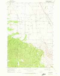
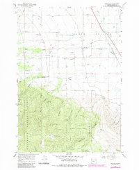
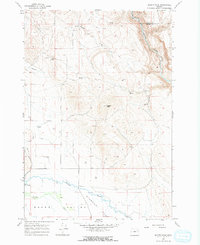
1967 Map of Wingville
USGS Topo · Published 1972About this map
The Baker Valley agricultural landscape meets the timbered slopes of the Whitman National Forest in this late 1960s survey. Irrigation infrastructure, vital for high-desert farming, is extensively documented through features like the Salmon Aqueduct, Baker Municipal Aqueduct, and the Wilcox Ditch. The historic settlement of Wingville serves as a focal point, supported by the nearby Wingville Cem and the Union Pacific rail line running through Old Wing Slough. In the southern highlands, the map records the region's mining legacy with the Young America Mine and Stub Mine tucked away in the gulches. Recreational sites such as the Ebell Picnic Area and Marble Creek Picnic Area mark the transition from the valley floor to the forested terrain, where numerous drainages like Hibbard Gulch and Rouen Gulch carve through the landscape.
Find a feature on this map
38 named features on this map. Tap any name to fly to it.
Don’t see what you’re looking for? This feature index may not catch every label — zoom into the map to look around manually.
Map Details
Editions of this 1967 Wingville Map
2 editions found
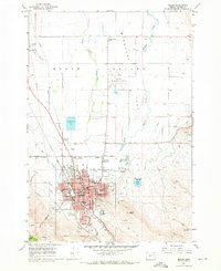
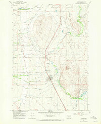
Other maps of this area

1901 · Baker City
USGS Topo · 1:125,000

1901 · Sumpter
USGS Topo · 1:125,000

1955 · Baker
USGS Topo · 1:250,000

1955 · Canyon City
USGS Topo · 1:250,000

1959 · Baker
USGS Topo · 1:250,000

1959 · Canyon City
USGS Topo · 1:250,000
1967 · Baker
USGS Topo · 1:24,000
1967 · Haines
USGS Topo · 1:24,000
1967 · Magpie Peak
USGS Topo · 1:24,000
1967 · Blue Canyon
USGS Topo · 1:24,000