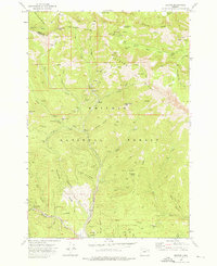
1972 Map of Sumpter
USGS Topo · Published 1976About this map
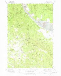
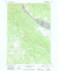
Sumpter stands as a focal point in this high-country landscape, positioned at the confluence of McCully Fork and Cracker Creek. The map vividly illustrates the long-term impact of gold mining operations, with extensive Dredge Tailings dominating the floor of the Sumpter Valley along the Powder River. These serpentine mounds of gravel follow the river's course for miles, reflecting a massive industrial effort that reshaped the local topography.
Find a feature on this map
62 named features on this map. Tap any name to fly to it.
Don’t see what you’re looking for? This feature index may not catch every label — zoom into the map to look around manually.
Map Details
Editions of this 1972 Sumpter Map
2 editions found
Other maps of this area

1901 · Sumpter
USGS Topo · 1:125,000

1955 · Canyon City
USGS Topo · 1:250,000

1959 · Canyon City
USGS Topo · 1:250,000
1961 · Whitney
USGS Topo · 1:24,000
1972 · Elkhorn Peak
USGS Topo · 1:24,000

1972 · Mt. Ireland
USGS Topo · 1:24,000
1972 · Bourne
USGS Topo · 1:24,000
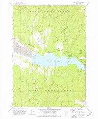
1972 · Phillips Lake
USGS Topo · 1:24,000
1972 · Beaverdam Creek
USGS Topo · 1:24,000
1972 · Unity Reservoir
USGS Topo · 1:24,000