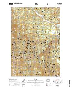
2020 Map of Bates
USGS Topo · Published 2020About this map
The Middle Fork John Day River winds through this section of Grant County, anchoring a landscape defined by the intersection of mountain timber and waterway history. The settlement of Bates and the nearby Bates Pond sit in the northeastern corner, marking a center of local activity near the Austin Spur. This area is heavily forested, primarily encompassed by the Malheur National Forest, where steep drainages like Dead Cow Gulch and Placer Gulch feed into the river system.
Find a feature on this map
29 named features on this map. Tap any name to fly to it.
Don’t see what you’re looking for? This feature index may not catch every label — zoom into the map to look around manually.
Map Details
Editions of this 2020 Bates Map
This is the sole edition of this map. No revisions or reprints were ever made.
Other maps of this area

1901 · Sumpter
USGS Topo · 1:125,000

1908 · Ironside Mountain
USGS Topo · 1:125,000

1951 · Bates
USGS Topo · 1:62,500

1955 · Canyon City
USGS Topo · 1:250,000

1959 · Canyon City
USGS Topo · 1:250,000

1959 · Prairie City
USGS Topo · 1:62,500

1972 · Austin
USGS Topo · 1:24,000
1972 · Deardorff Mtn
USGS Topo · 1:24,000

1972 · Greenhorn
USGS Topo · 1:24,000

1978 · John Day
USGS Topo · 1:100,000