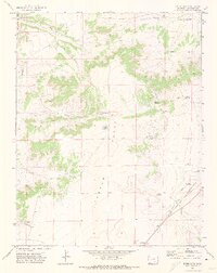
1971 Map of Bates Lake
USGS Topo · Published 1974About this map
Tyrone Flats and the expansive drainage of the Apishapa River characterize this portion of Las Animas County in the early 1970s. The landscape is defined by its water management and transit corridors, notably the Atchison Topeka and Santa Fe railroad line running parallel to Timpas Creek in the southeast. A significant historical layer is preserved through the Santa Fe Trail (Approximate Location), which traces a path through this high-plains terrain. The map details a network of ranching infrastructure, including numerous named water sources like Bates Lake, Baker Reservoir, and Rowe Reservoir. The presence of several family-named landmarks, such as the Smith Ranch Windmill, Sutton Windmill, and Eperson Windmill, provides specific points of interest for genealogists tracing the agricultural footprint of the area. Additionally, the Apishapa Game Management Area occupies the northwestern corner, signifying the region's role in wildlife conservation.
Find a feature on this map
26 named features on this map. Tap any name to fly to it.
Don’t see what you’re looking for? This feature index may not catch every label — zoom into the map to look around manually.
Map Details
Editions of this 1971 Bates Lake Map
2 editions found
Other maps of this area

1891 · Apishapa
USGS Topo · 1:125,000

1892 · Elmoro
USGS Topo · 1:125,000

1893 · Apishapa
USGS Topo · 1:125,000

1893 · Elmoro
USGS Topo · 1:125,000

1897 · Elmoro
USGS Topo · 1:125,000

1897 · Apishapa
USGS Topo · 1:125,000

1954 · Trinidad
USGS Topo · 1:250,000

1955 · Trinidad
USGS Topo · 1:250,000

1958 · Trinidad
USGS Topo · 1:250,000

1959 · Trinidad
USGS Topo · 1:250,000