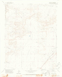
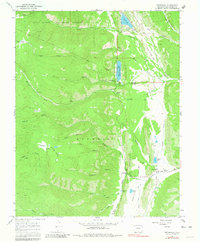
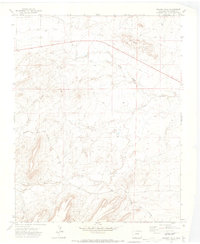
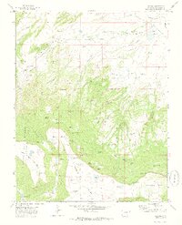
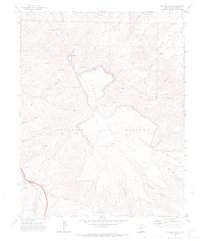
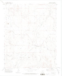
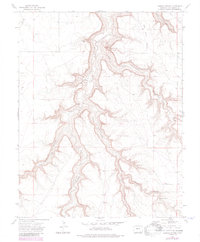
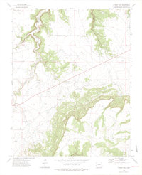
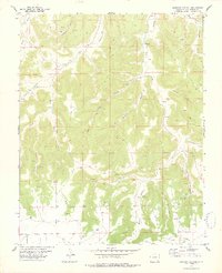
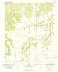
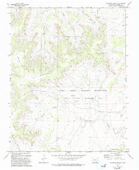
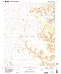
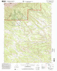
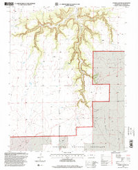
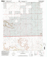
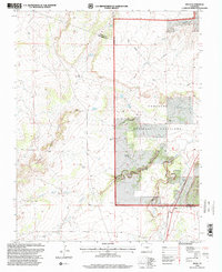
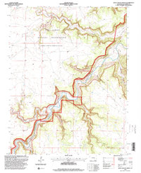
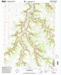
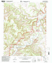
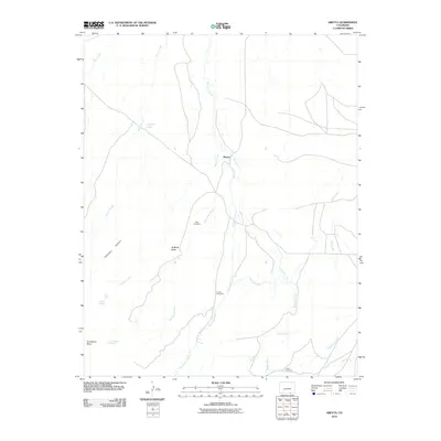
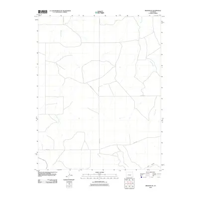
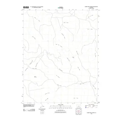
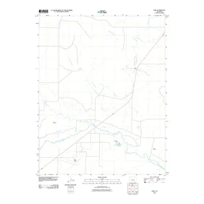
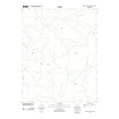
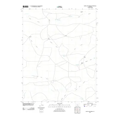
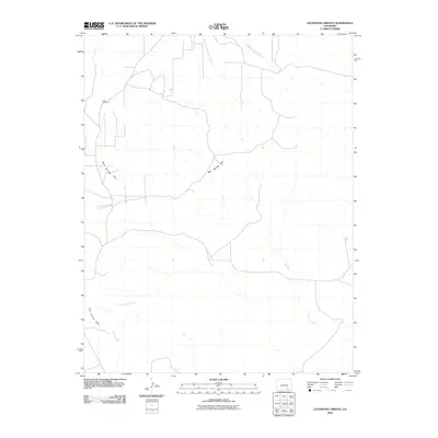
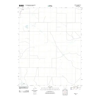
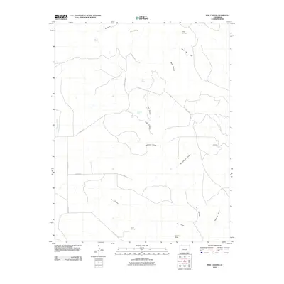
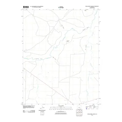
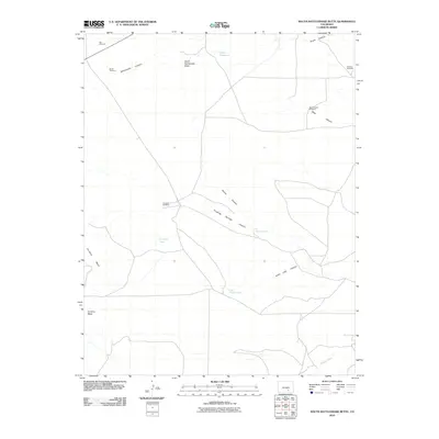
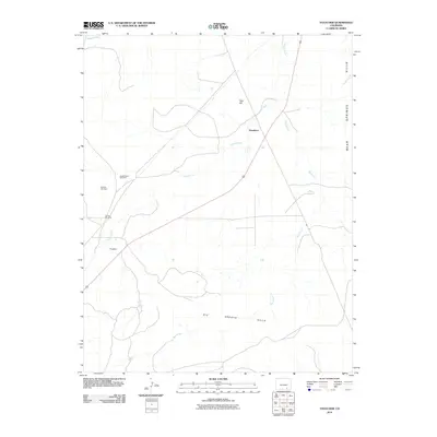
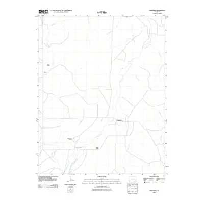
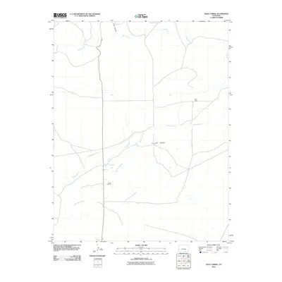
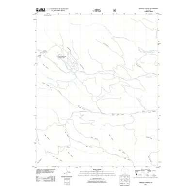
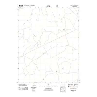
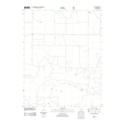
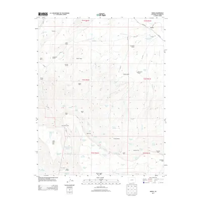
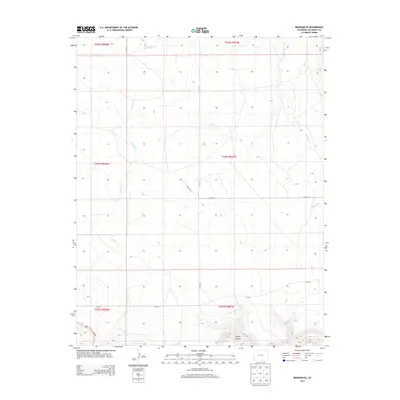
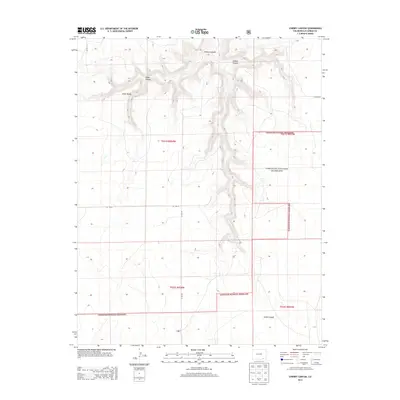
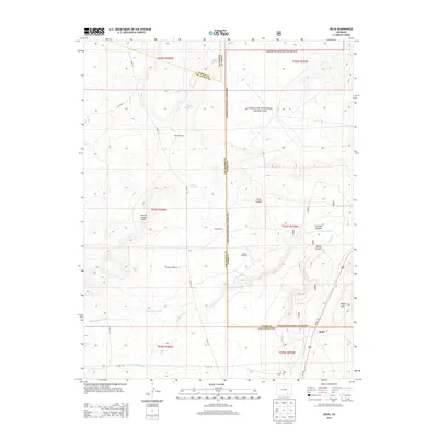
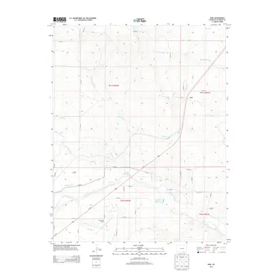
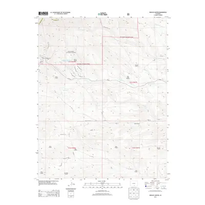
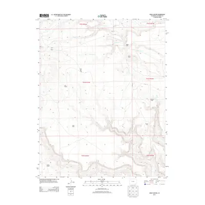
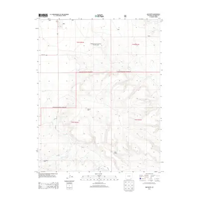
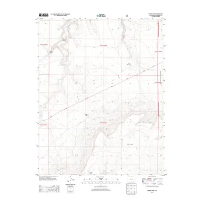
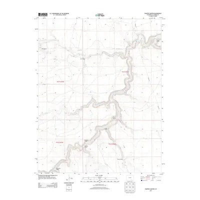
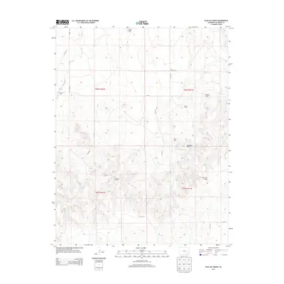
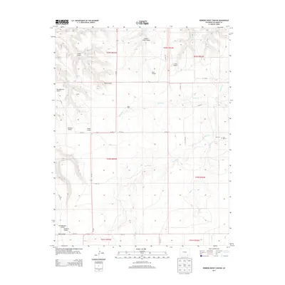
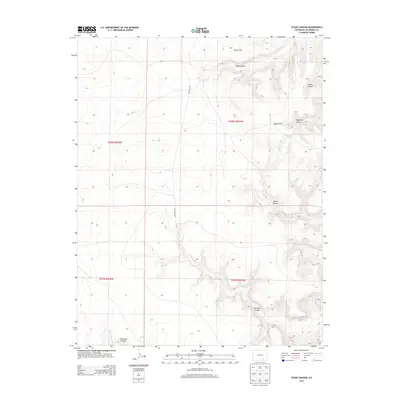
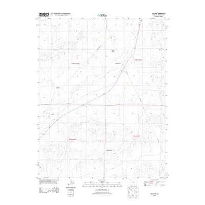
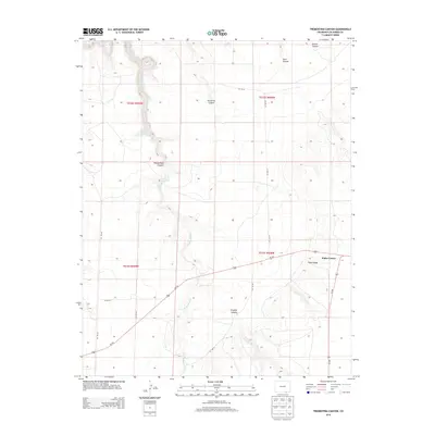
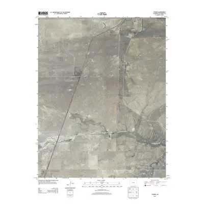
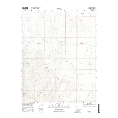
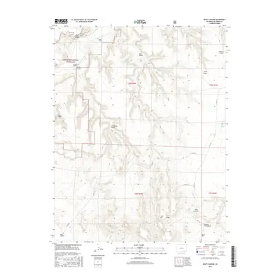
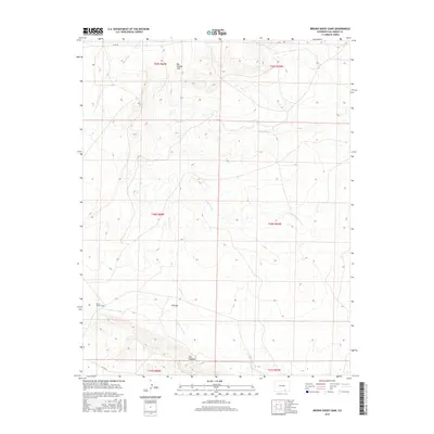
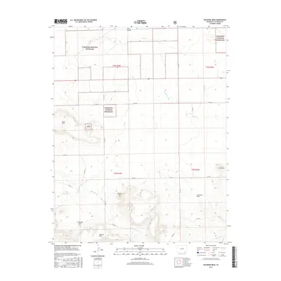
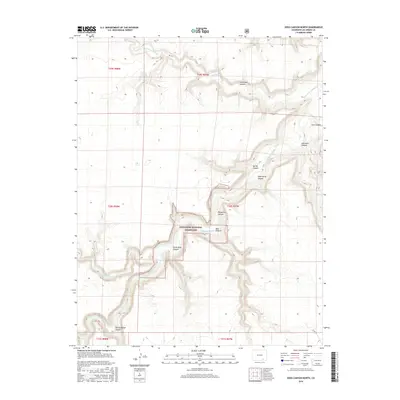
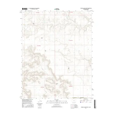
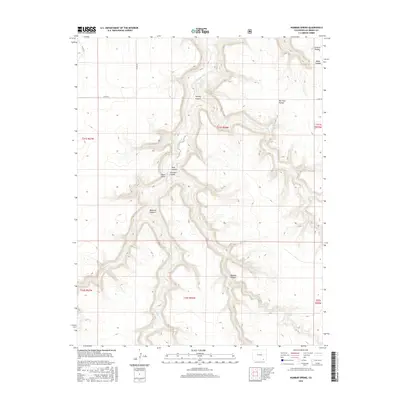
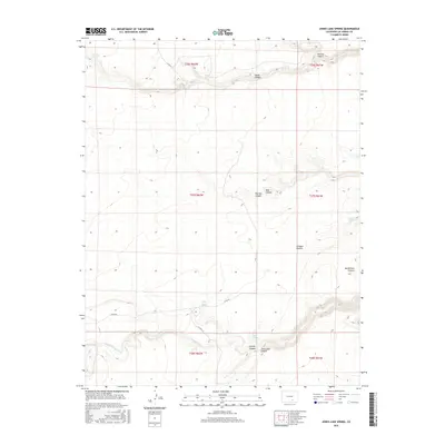
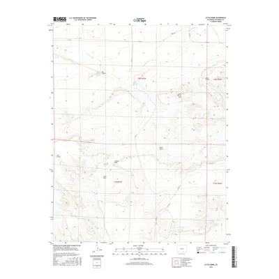
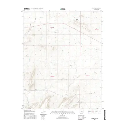
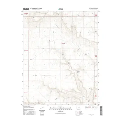
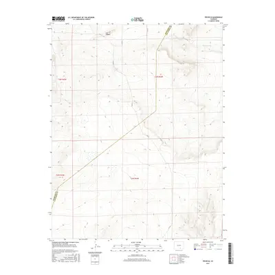
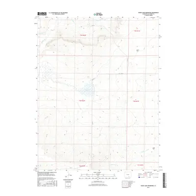
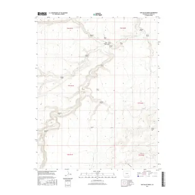
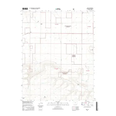
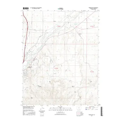
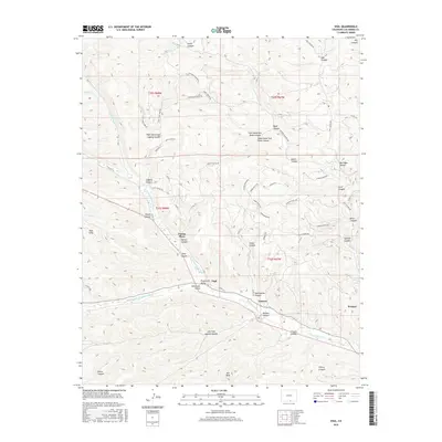
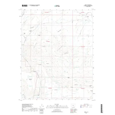
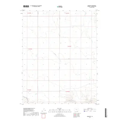
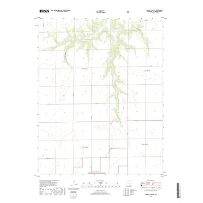
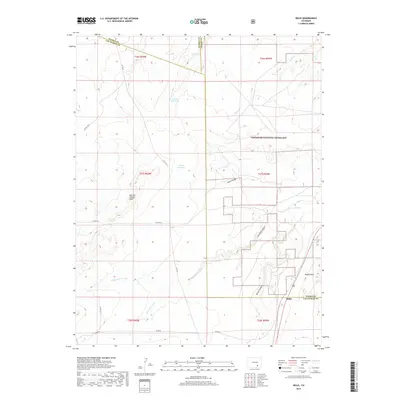
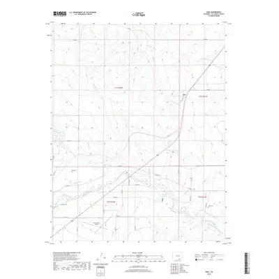
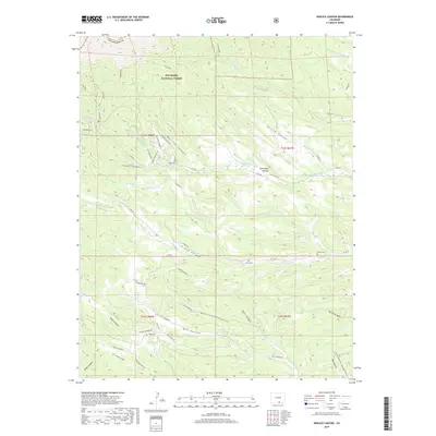
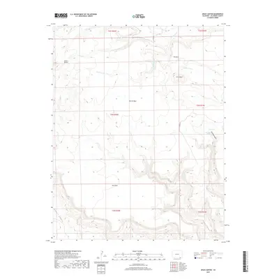
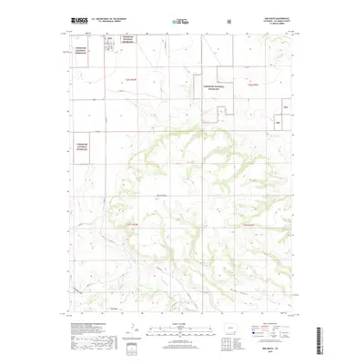
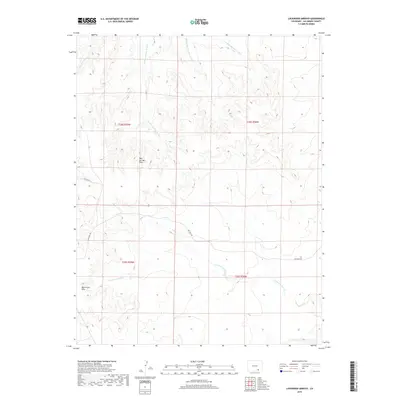
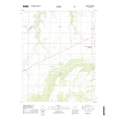
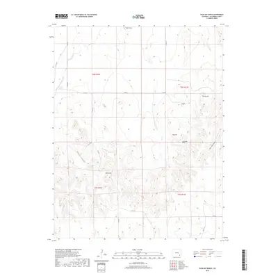
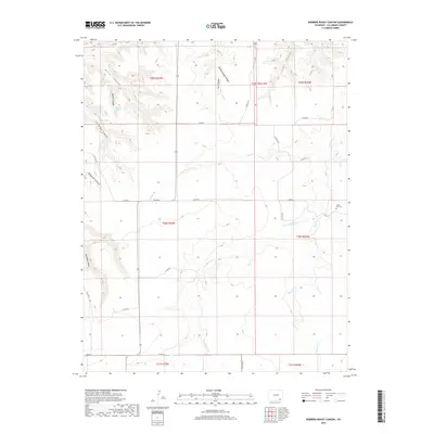
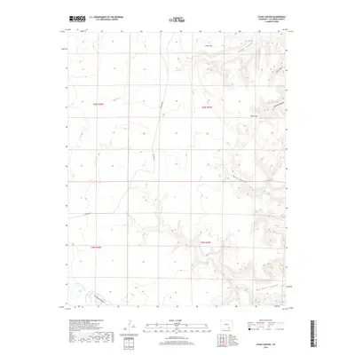
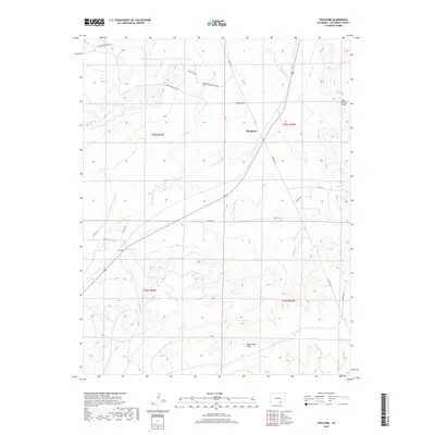
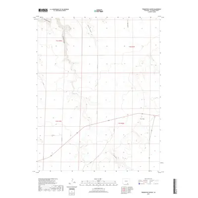
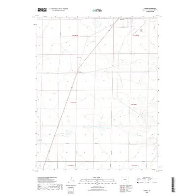
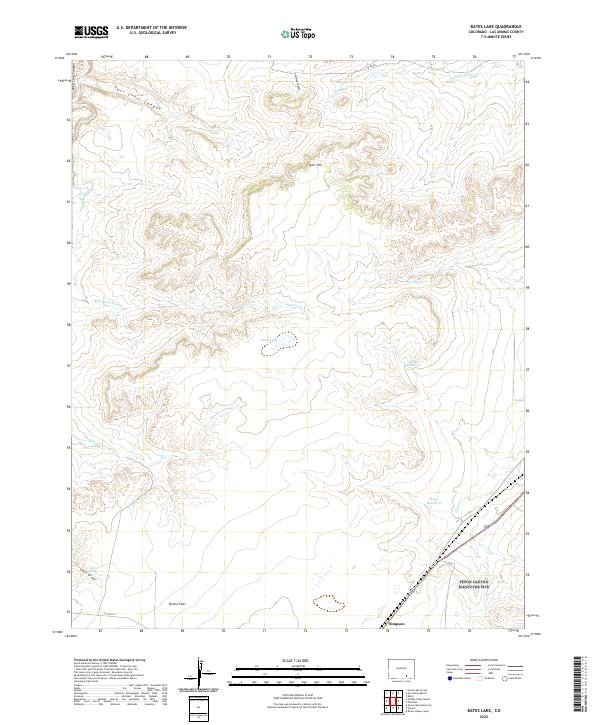
1971 Map of Bates Lake
USGS Topo · Published 1974About this map
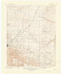
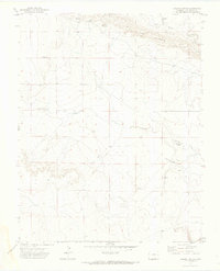
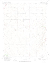
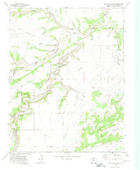
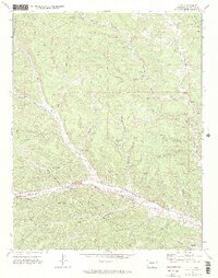
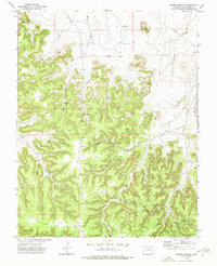
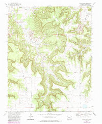
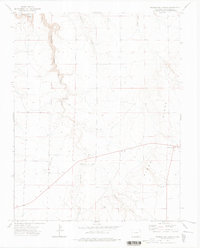
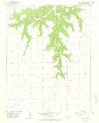
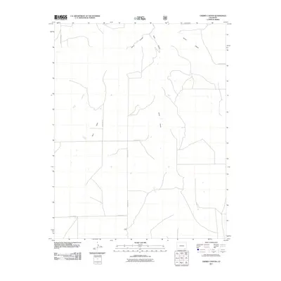
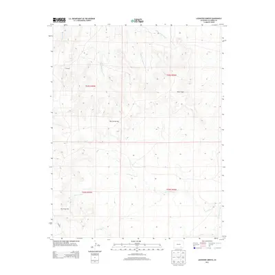
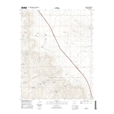
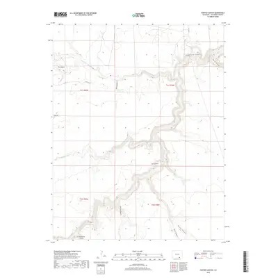
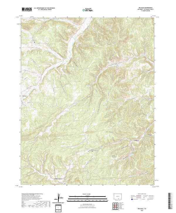
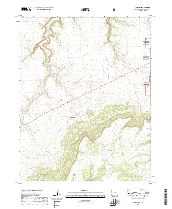
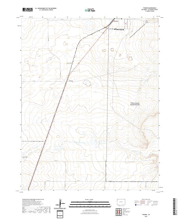
Poitrey and Simpson anchor this high-plains landscape in Las Animas County, captured during a 1971 field survey. The terrain is defined by the broad expanse of the Tyrone Flats and the drainage of the Apishapa River, which borders the Apishapa Game Management Area. The map reveals a livestock-centric economy dependent on scattered water sources, including Bates Lake, Baker Reservoir, and numerous named windmills such as Epperson Windmill and the Smith Ranch Windmill. A significant historical corridor is preserved here, as the map identifies the approximate location of the Santa Fe and Topeka Trail running parallel to the modern tracks of the Atchison Topeka and Santa Fe railroad near Timpas Creek. These overlapping transportation routes through Elmore Arroyo and East Cross Canyon illustrate the long-standing importance of this path for travel and commerce across the Colorado plains.
Find a feature on this map
29 named features on this map. Tap any name to fly to it.
Don’t see what you’re looking for? This feature index may not catch every label — zoom into the map to look around manually.
Map Details
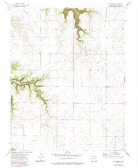
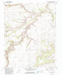
Editions of this 1971 Bates Lake Map
2 editions found
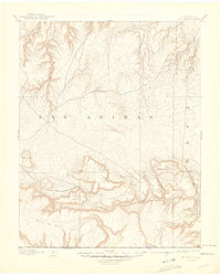
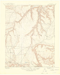
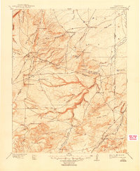
Historical Maps of Las Animas County Through Time
459 maps found

1891 Apishapa
Las Animas County, CO

1891 Mesa De Maya
Las Animas County, CO

1892 Elmoro
Las Animas County, CO
1892 Mount Carrizo
Las Animas County, CO

1893 Apishapa
Las Animas County, CO

1893 Elmoro
Las Animas County, CO
1893 Mesa De Maya
Las Animas County, CO

1895 Spanish Peaks
Las Animas County, CO
1897 Apishapa
Las Animas County, CO
1897 Elmoro
Las Animas County, CO
1897 Spanish Peaks
Las Animas County, CO

1900 Spanish Peaks
Las Animas County, CO
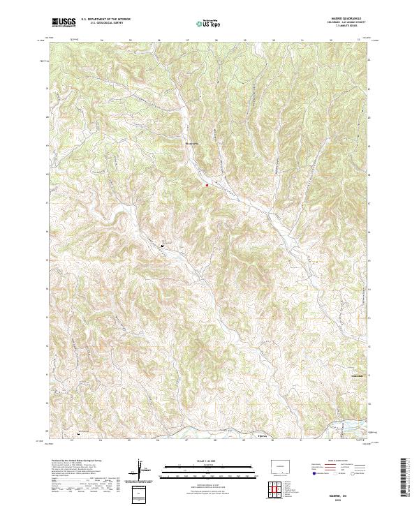
1951 Madrid
Las Animas County, CO
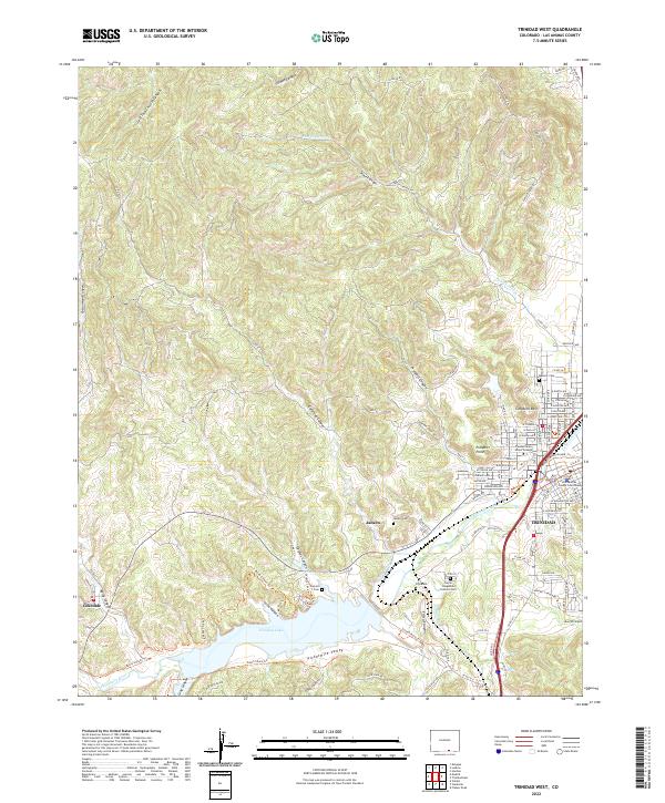
1951 Trinidad West
Las Animas County, CO
1967 Stonewall
Las Animas County, CO
1967 Torres
Las Animas County, CO
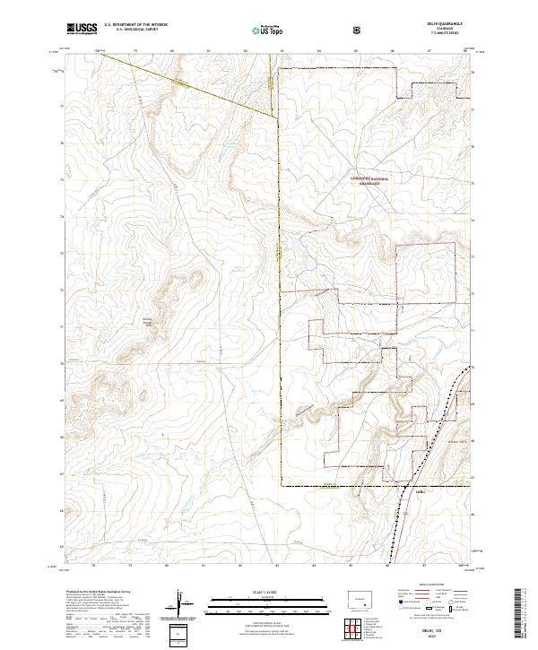
1970 Delhi
Las Animas County, CO
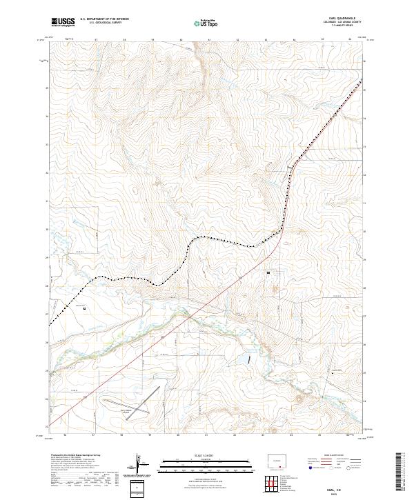
1970 Earl
Las Animas County, CO
1970 Mooney Hills
Las Animas County, CO
1970 Pryor SE
Las Animas County, CO
1970 Thatcher
Las Animas County, CO
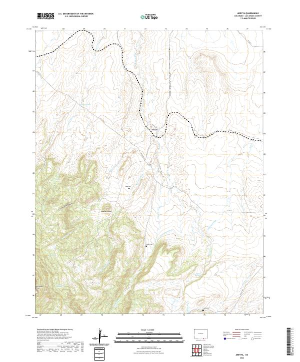
1971 Abeyta
Las Animas County, CO
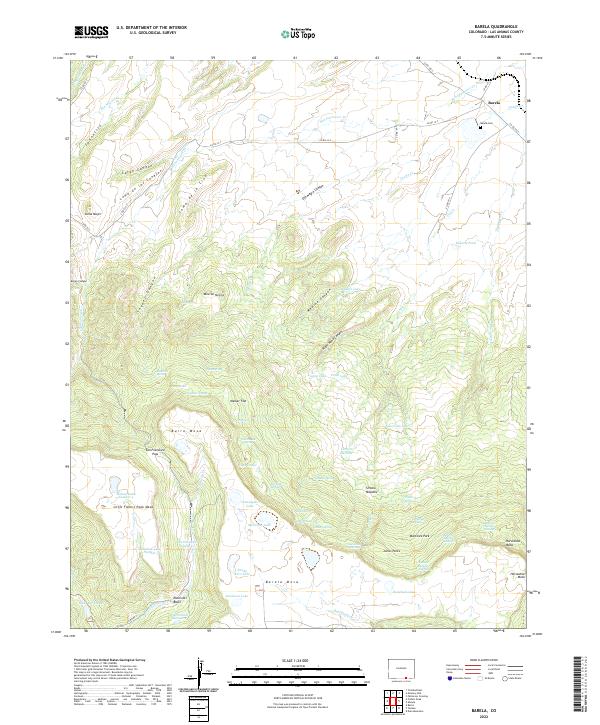
1971 Barela
Las Animas County, CO
1971 Bates Lake
Las Animas County, CO
1971 Brown Sheep Camp
Las Animas County, CO
1971 Delagua
Las Animas County, CO
1971 Fishers Peak
Las Animas County, CO

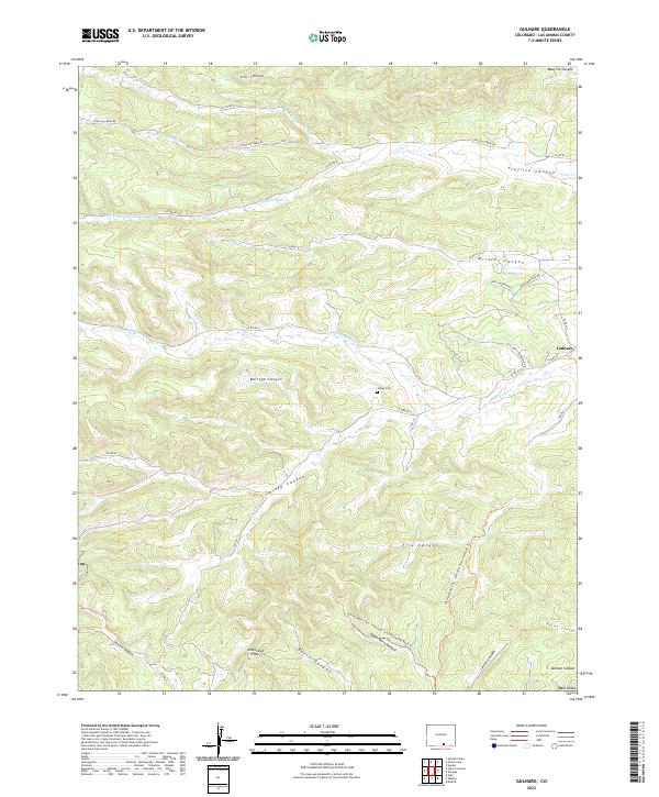
1971 Gulnare
Las Animas County, CO
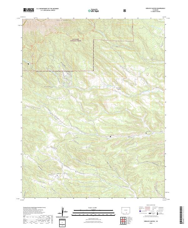
1971 Herlick Canyon
Las Animas County, CO
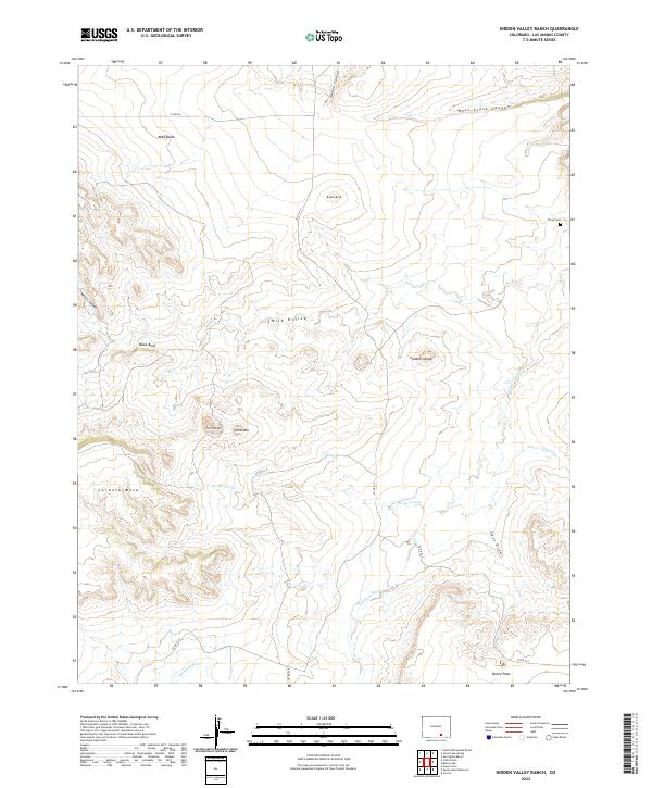
1971 Hidden Valley Ranch
Las Animas County, CO
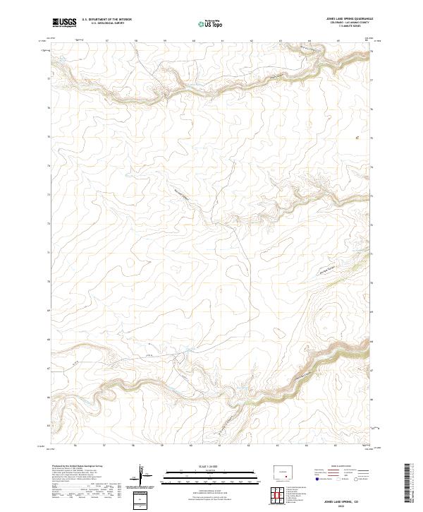
1971 Jones Lake Spring
Las Animas County, CO
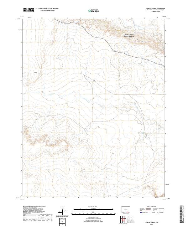
1971 Lambing Spring
Las Animas County, CO
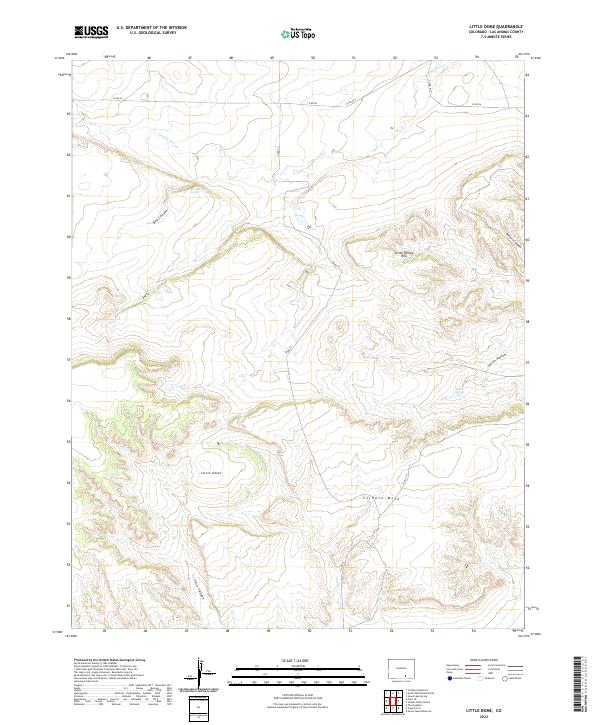
1971 Little Dome
Las Animas County, CO
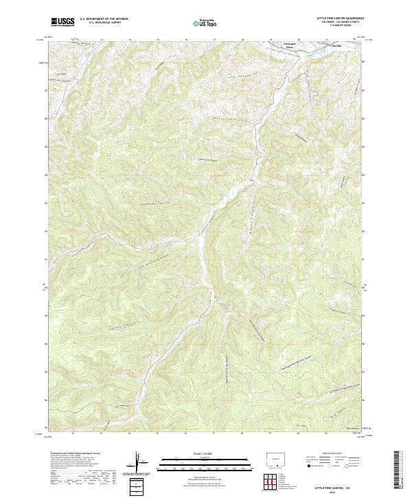
1971 Little Pine Canyon
Las Animas County, CO
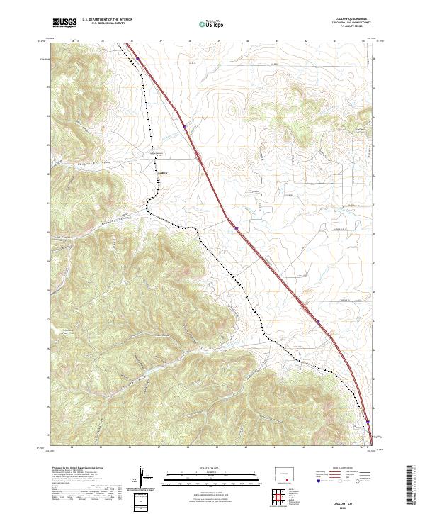
1971 Ludlow
Las Animas County, CO
1971 Model
Las Animas County, CO

1971 Patterson Crossing
Las Animas County, CO
1971 Plug Hat Ranch
Las Animas County, CO
1971 Seven Lakes Reservoir
Las Animas County, CO
1971 South Rattlesnake Butte
Las Animas County, CO
1971 Sun Valley Ranch
Las Animas County, CO
1971 Tercio
Las Animas County, CO
1971 The Hogback
Las Animas County, CO
1971 Trinchera Cave
Las Animas County, CO
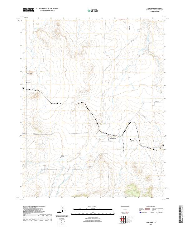
1971 Trinchera
Las Animas County, CO
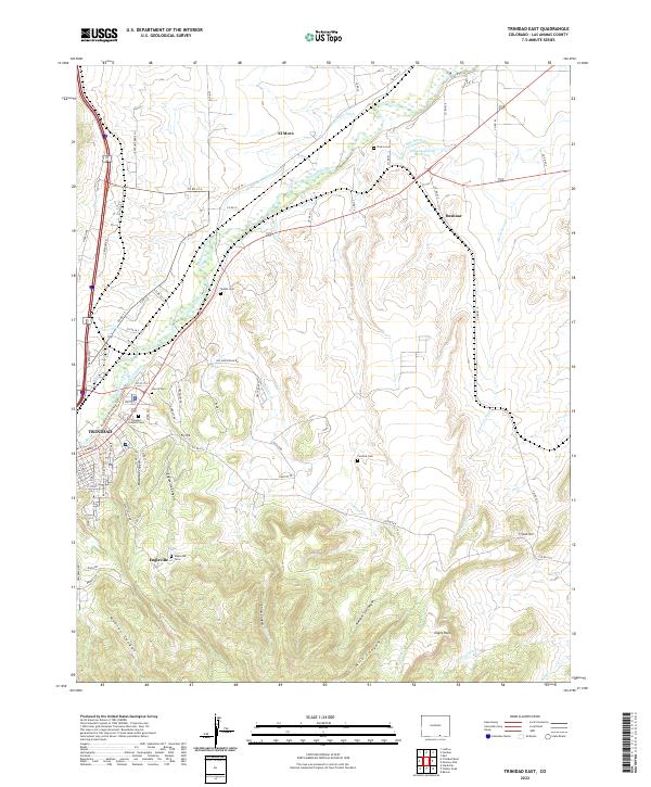
1971 Trinidad East
Las Animas County, CO
1971 Tyrone
Las Animas County, CO
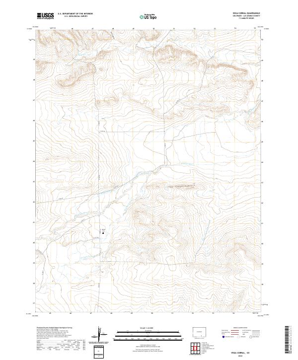
1971 Vega Corral
Las Animas County, CO
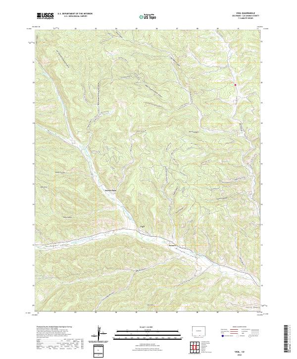
1971 Vigil
Las Animas County, CO
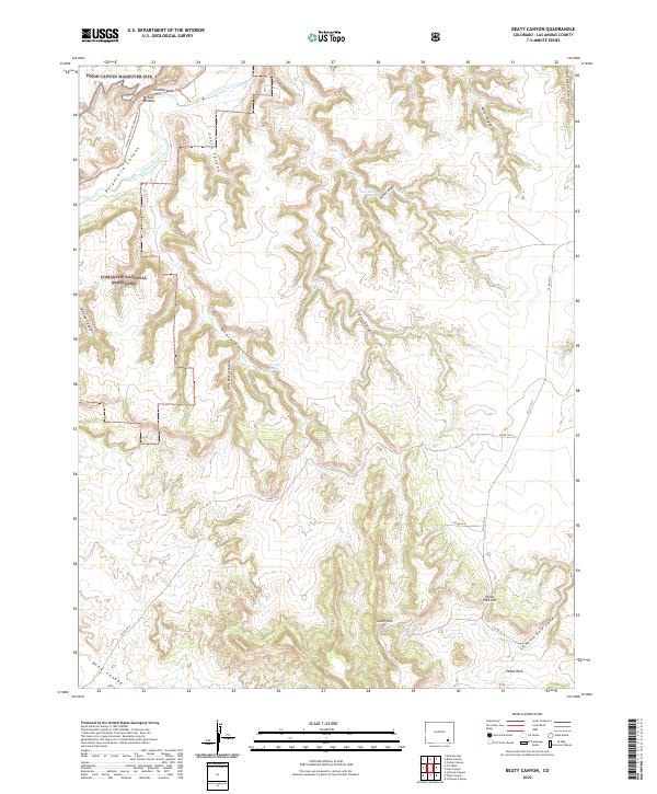
1972 Beaty Canyon
Las Animas County, CO
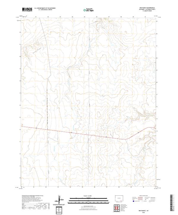
1972 Box Ranch
Las Animas County, CO
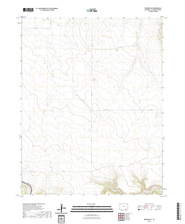
1972 Branson SE
Las Animas County, CO
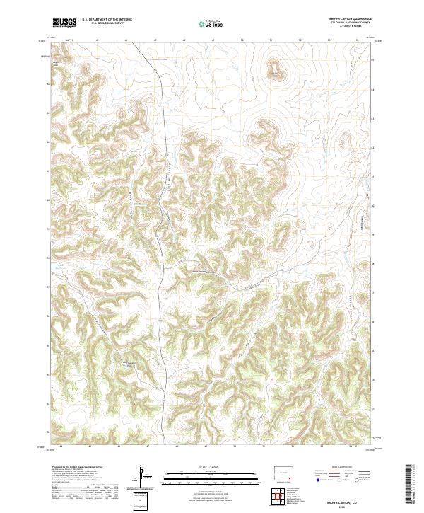
1972 Brown Canyon
Las Animas County, CO
1972 Cobert Mesa North
Las Animas County, CO
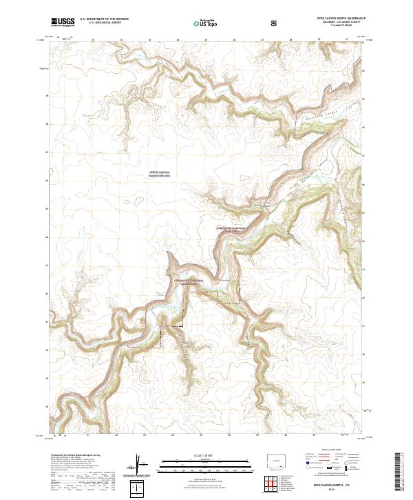
1972 Doss Canyon North
Las Animas County, CO
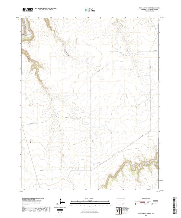
1972 Doss Canyon South
Las Animas County, CO
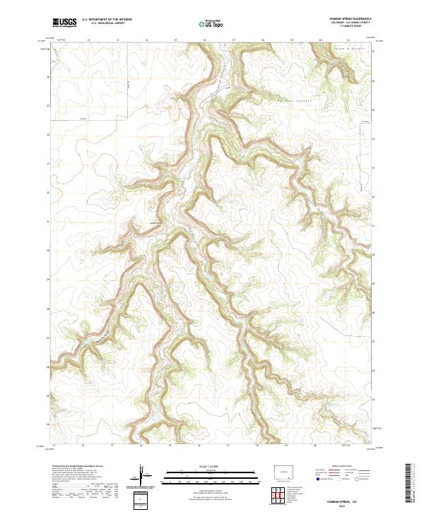
1972 Humbar Spring
Las Animas County, CO
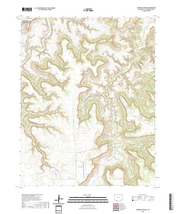
1972 Johnson Canyon
Las Animas County, CO
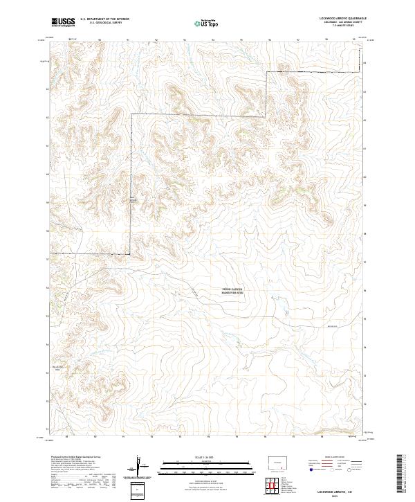
1972 Lockwood Arroyo
Las Animas County, CO
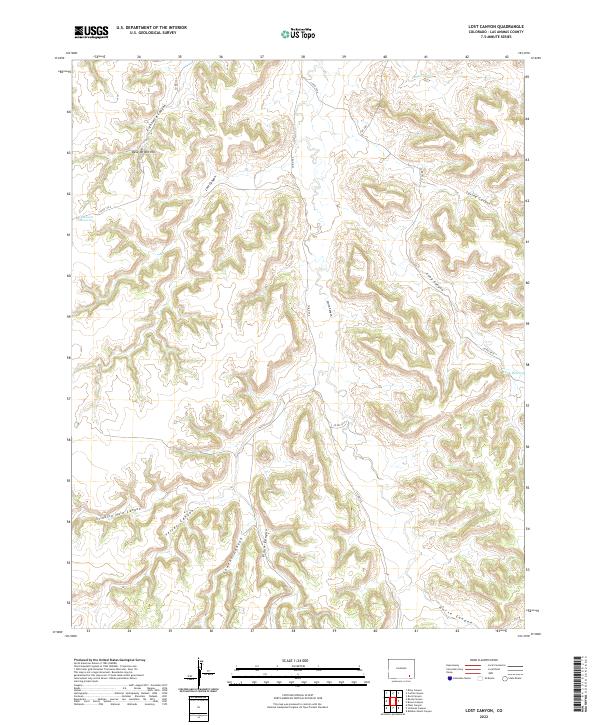
1972 Lost Canyon
Las Animas County, CO
1972 Miners Peak
Las Animas County, CO
1972 O V Mesa
Las Animas County, CO
1972 Painted Canyon
Las Animas County, CO
1972 Pine Canyon
Las Animas County, CO
1972 Plum Canyon
Las Animas County, CO
1972 Rock Crossing
Las Animas County, CO
1972 Stage Canyon
Las Animas County, CO
1972 Tobe
Las Animas County, CO
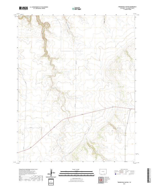
1972 Trementina Canyon
Las Animas County, CO
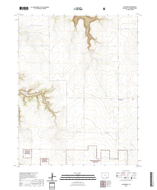
1972 Villegreen
Las Animas County, CO
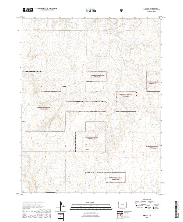
1978 Andrix
Las Animas County, CO
1978 Buck Canyon
Las Animas County, CO
1978 Cherry Canyon
Las Animas County, CO
1978 Dalerose Mesa
Las Animas County, CO
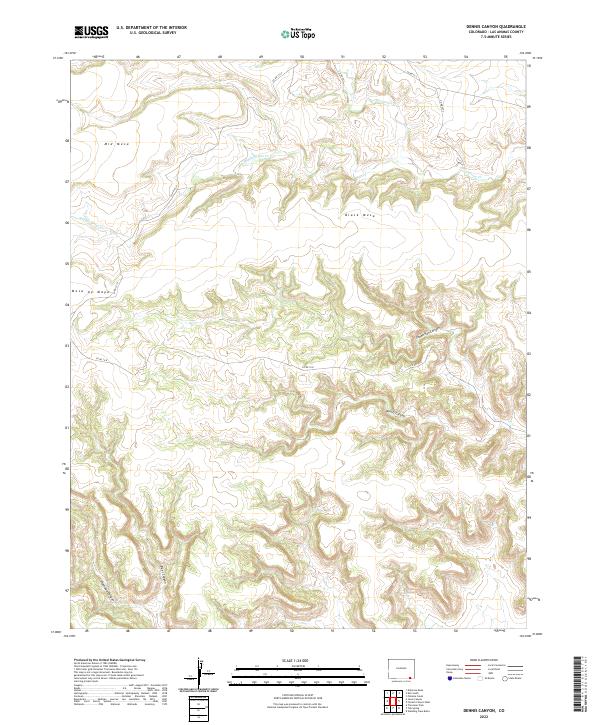
1978 Dennis Canyon
Las Animas County, CO
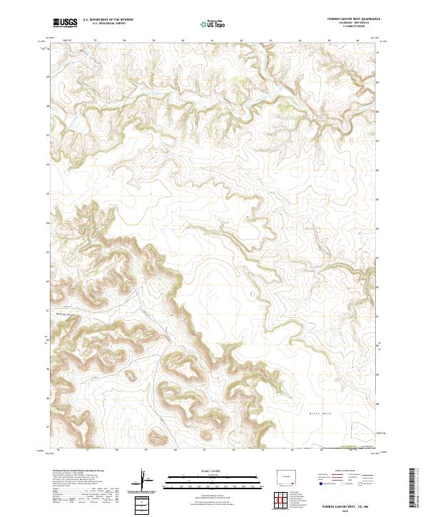
1978 Furnish Canyon West
Las Animas County, CO
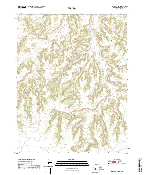
1978 Icehouse Canyon
Las Animas County, CO
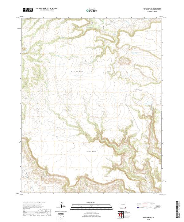
1978 Jesus Canyon
Las Animas County, CO
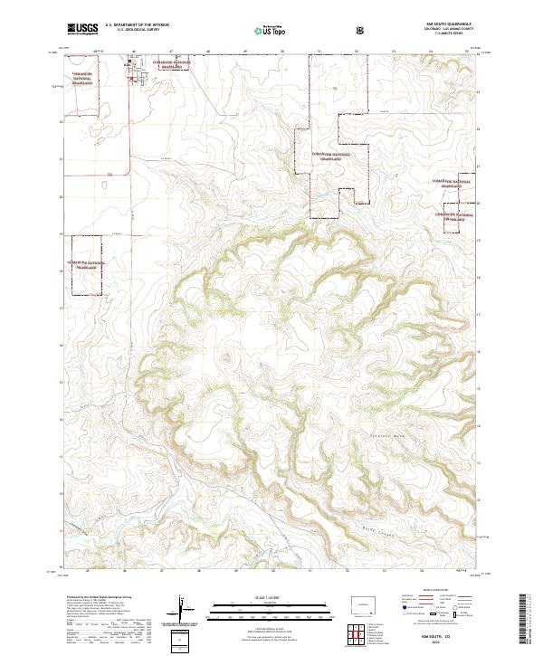
1978 Kim South
Las Animas County, CO
1978 Pintada Creek
Las Animas County, CO
1978 Robbers Roost Canyon
Las Animas County, CO
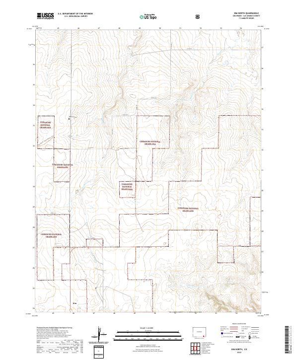
1979 Kim North
Las Animas County, CO
1993 Bates Lake
Las Animas County, CO
1993 Brown Sheep Camp
Las Animas County, CO

1993 Delhi
Las Animas County, CO
1993 Lockwood Arroyo
Las Animas County, CO
1993 Model
Las Animas County, CO
1993 O V Mesa
Las Animas County, CO
1993 Rock Crossing
Las Animas County, CO
1993 Stage Canyon
Las Animas County, CO
1993 Sun Valley Ranch
Las Animas County, CO
1993 Thatcher
Las Animas County, CO
1993 Tyrone
Las Animas County, CO
1994 Herlick Canyon
Las Animas County, CO
1994 Stonewall
Las Animas County, CO
1996 Andrix
Las Animas County, CO
1996 Beaty Canyon
Las Animas County, CO
1996 Cherry Canyon
Las Animas County, CO
1996 Dalerose Mesa
Las Animas County, CO
1996 Delhi
Las Animas County, CO
1996 Doss Canyon North
Las Animas County, CO
1996 Humbar Spring
Las Animas County, CO
1996 Kim North
Las Animas County, CO
1996 Kim South
Las Animas County, CO
1996 Miners Peak
Las Animas County, CO
1996 O V Mesa
Las Animas County, CO
1996 Pintada Creek
Las Animas County, CO
1996 Tobe
Las Animas County, CO
1996 Villegreen
Las Animas County, CO
2010 Abeyta
Las Animas County, CO
2010 Barela
Las Animas County, CO
2010 Bates Lake
Las Animas County, CO
2010 Box Ranch
Las Animas County, CO
2010 Branson SE
Las Animas County, CO
2010 Brown Canyon
Las Animas County, CO
2010 Brown Sheep Camp
Las Animas County, CO
2010 Buck Canyon
Las Animas County, CO
2010 Cobert Mesa North
Las Animas County, CO
2010 Delagua
Las Animas County, CO
2010 Dennis Canyon
Las Animas County, CO
2010 Doss Canyon South
Las Animas County, CO
2010 Earl
Las Animas County, CO
2010 Fishers Peak
Las Animas County, CO
2010 Furnish Canyon West
Las Animas County, CO
2010 Gulnare
Las Animas County, CO
2010 Hidden Valley Ranch
Las Animas County, CO
2010 Icehouse Canyon
Las Animas County, CO
2010 Jesus Canyon
Las Animas County, CO
2010 Johnson Canyon
Las Animas County, CO
2010 Jones Lake Spring
Las Animas County, CO
2010 Lambing Spring
Las Animas County, CO
2010 Little Dome
Las Animas County, CO
2010 Little Pine Canyon
Las Animas County, CO
2010 Lockwood Arroyo
Las Animas County, CO
2010 Lost Canyon
Las Animas County, CO
2010 Ludlow
Las Animas County, CO
2010 Madrid
Las Animas County, CO
2010 Model
Las Animas County, CO
2010 Mooney Hills
Las Animas County, CO
2010 Painted Canyon
Las Animas County, CO
2010 Patterson Crossing
Las Animas County, CO
2010 Pine Canyon
Las Animas County, CO
2010 Plug Hat Ranch
Las Animas County, CO
2010 Plum Canyon
Las Animas County, CO
2010 Pryor SE
Las Animas County, CO
2010 Purgatoire Canyon
Las Animas County, CO
2010 Robbers Roost Canyon
Las Animas County, CO
2010 Rock Crossing
Las Animas County, CO
2010 Seven Lakes Reservoir
Las Animas County, CO
2010 South Rattlesnake Butte
Las Animas County, CO
2010 Stage Canyon
Las Animas County, CO
2010 Sun Valley Ranch
Las Animas County, CO
2010 Tercio
Las Animas County, CO
2010 Thatcher
Las Animas County, CO
2010 The Hogback
Las Animas County, CO
2010 Torres
Las Animas County, CO
2010 Trementina Canyon
Las Animas County, CO
2010 Trinchera
Las Animas County, CO
2010 Trinidad East
Las Animas County, CO
2010 Trinidad West
Las Animas County, CO
2010 Tyrone
Las Animas County, CO
2010 Vega Corral
Las Animas County, CO
2010 Vigil
Las Animas County, CO
2011 Andrix
Las Animas County, CO
2011 Beaty Canyon
Las Animas County, CO
2011 Cherry Canyon
Las Animas County, CO
2011 Dalerose Mesa
Las Animas County, CO
2011 Delhi
Las Animas County, CO
2011 Doss Canyon North
Las Animas County, CO
2011 Herlick Canyon
Las Animas County, CO
2011 Humbar Spring
Las Animas County, CO
2011 Kim North
Las Animas County, CO
2011 Kim South
Las Animas County, CO
2011 Miners Peak
Las Animas County, CO
2011 O V Mesa
Las Animas County, CO
2011 Pintada Creek
Las Animas County, CO
2011 Stonewall
Las Animas County, CO
2011 Tobe
Las Animas County, CO
2011 Villegreen
Las Animas County, CO
2013 Abeyta
Las Animas County, CO
2013 Andrix
Las Animas County, CO
2013 Barela
Las Animas County, CO
2013 Bates Lake
Las Animas County, CO
2013 Beaty Canyon
Las Animas County, CO
2013 Box Ranch
Las Animas County, CO
2013 Branson SE
Las Animas County, CO
2013 Brown Canyon
Las Animas County, CO
2013 Brown Sheep Camp
Las Animas County, CO
2013 Buck Canyon
Las Animas County, CO
2013 Cherry Canyon
Las Animas County, CO
2013 Cobert Mesa North
Las Animas County, CO
2013 Dalerose Mesa
Las Animas County, CO
2013 Delagua
Las Animas County, CO
2013 Delhi
Las Animas County, CO
2013 Dennis Canyon
Las Animas County, CO
2013 Doss Canyon North
Las Animas County, CO
2013 Doss Canyon South
Las Animas County, CO
2013 Earl
Las Animas County, CO
2013 Fishers Peak
Las Animas County, CO
2013 Furnish Canyon West
Las Animas County, CO
2013 Gulnare
Las Animas County, CO
2013 Herlick Canyon
Las Animas County, CO
2013 Hidden Valley Ranch
Las Animas County, CO
2013 Humbar Spring
Las Animas County, CO
2013 Icehouse Canyon
Las Animas County, CO
2013 Jesus Canyon
Las Animas County, CO
2013 Johnson Canyon
Las Animas County, CO
2013 Jones Lake Spring
Las Animas County, CO
2013 Kim North
Las Animas County, CO
2013 Kim South
Las Animas County, CO
2013 Lambing Spring
Las Animas County, CO
2013 Little Dome
Las Animas County, CO
2013 Little Pine Canyon
Las Animas County, CO
2013 Lockwood Arroyo
Las Animas County, CO
2013 Lost Canyon
Las Animas County, CO
2013 Ludlow
Las Animas County, CO
2013 Madrid
Las Animas County, CO
2013 Miners Peak
Las Animas County, CO
2013 Model
Las Animas County, CO
2013 Mooney Hills
Las Animas County, CO
2013 O V Mesa
Las Animas County, CO
2013 Painted Canyon
Las Animas County, CO
2013 Patterson Crossing
Las Animas County, CO
2013 Pine Canyon
Las Animas County, CO
2013 Pintada Creek
Las Animas County, CO
2013 Plug Hat Ranch
Las Animas County, CO
2013 Plum Canyon
Las Animas County, CO
2013 Pryor SE
Las Animas County, CO
2013 Purgatoire Canyon
Las Animas County, CO
2013 Robbers Roost Canyon
Las Animas County, CO
2013 Rock Crossing
Las Animas County, CO
2013 Seven Lakes Reservoir
Las Animas County, CO
2013 South Rattlesnake Butte
Las Animas County, CO
2013 Stage Canyon
Las Animas County, CO
2013 Stonewall
Las Animas County, CO
2013 Sun Valley Ranch
Las Animas County, CO
2013 Tercio
Las Animas County, CO
2013 Thatcher
Las Animas County, CO
2013 The Hogback
Las Animas County, CO
2013 Tobe
Las Animas County, CO
2013 Torres
Las Animas County, CO
2013 Trementina Canyon
Las Animas County, CO
2013 Trinchera
Las Animas County, CO
2013 Trinidad East
Las Animas County, CO
2013 Trinidad West
Las Animas County, CO
2013 Tyrone
Las Animas County, CO
2013 Vega Corral
Las Animas County, CO
2013 Vigil
Las Animas County, CO
2013 Villegreen
Las Animas County, CO
2016 Abeyta
Las Animas County, CO
2016 Andrix
Las Animas County, CO
2016 Barela
Las Animas County, CO
2016 Bates Lake
Las Animas County, CO
2016 Beaty Canyon
Las Animas County, CO
2016 Box Ranch
Las Animas County, CO
2016 Branson SE
Las Animas County, CO
2016 Brown Canyon
Las Animas County, CO
2016 Brown Sheep Camp
Las Animas County, CO
2016 Buck Canyon
Las Animas County, CO
2016 Cherry Canyon
Las Animas County, CO
2016 Cobert Mesa North
Las Animas County, CO
2016 Dalerose Mesa
Las Animas County, CO
2016 Delagua
Las Animas County, CO
2016 Delhi
Las Animas County, CO
2016 Dennis Canyon
Las Animas County, CO
2016 Doss Canyon North
Las Animas County, CO
2016 Doss Canyon South
Las Animas County, CO
2016 Earl
Las Animas County, CO
2016 Fishers Peak
Las Animas County, CO
2016 Furnish Canyon West
Las Animas County, CO
2016 Gulnare
Las Animas County, CO
2016 Herlick Canyon
Las Animas County, CO
2016 Hidden Valley Ranch
Las Animas County, CO
2016 Humbar Spring
Las Animas County, CO
2016 Icehouse Canyon
Las Animas County, CO
2016 Jesus Canyon
Las Animas County, CO
2016 Johnson Canyon
Las Animas County, CO
2016 Jones Lake Spring
Las Animas County, CO
2016 Kim North
Las Animas County, CO
2016 Kim South
Las Animas County, CO
2016 Lambing Spring
Las Animas County, CO
2016 Little Dome
Las Animas County, CO
2016 Little Pine Canyon
Las Animas County, CO
2016 Lockwood Arroyo
Las Animas County, CO
2016 Lost Canyon
Las Animas County, CO
2016 Ludlow
Las Animas County, CO
2016 Madrid
Las Animas County, CO
2016 Miners Peak
Las Animas County, CO
2016 Model
Las Animas County, CO
2016 Mooney Hills
Las Animas County, CO
2016 O V Mesa
Las Animas County, CO
2016 Painted Canyon
Las Animas County, CO
2016 Patterson Crossing
Las Animas County, CO
2016 Pine Canyon
Las Animas County, CO
2016 Pintada Creek
Las Animas County, CO
2016 Plug Hat Ranch
Las Animas County, CO
2016 Plum Canyon
Las Animas County, CO
2016 Pryor SE
Las Animas County, CO
2016 Purgatoire Canyon
Las Animas County, CO
2016 Robbers Roost Canyon
Las Animas County, CO
2016 Rock Crossing
Las Animas County, CO
2016 Seven Lakes Reservoir
Las Animas County, CO
2016 South Rattlesnake Butte
Las Animas County, CO
2016 Stage Canyon
Las Animas County, CO
2016 Stonewall
Las Animas County, CO
2016 Sun Valley Ranch
Las Animas County, CO
2016 Tercio
Las Animas County, CO
2016 Thatcher
Las Animas County, CO
2016 The Hogback
Las Animas County, CO
2016 Tobe
Las Animas County, CO
2016 Torres
Las Animas County, CO
2016 Trementina Canyon
Las Animas County, CO
2016 Trinchera
Las Animas County, CO
2016 Trinidad East
Las Animas County, CO
2016 Trinidad West
Las Animas County, CO
2016 Tyrone
Las Animas County, CO
2016 Vega Corral
Las Animas County, CO
2016 Vigil
Las Animas County, CO
2016 Villegreen
Las Animas County, CO
2019 Abeyta
Las Animas County, CO
2019 Andrix
Las Animas County, CO
2019 Barela
Las Animas County, CO
2019 Bates Lake
Las Animas County, CO
2019 Beaty Canyon
Las Animas County, CO
2019 Box Ranch
Las Animas County, CO
2019 Branson SE
Las Animas County, CO
2019 Brown Canyon
Las Animas County, CO
2019 Brown Sheep Camp
Las Animas County, CO
2019 Buck Canyon
Las Animas County, CO
2019 Cherry Canyon
Las Animas County, CO
2019 Cobert Mesa North
Las Animas County, CO
2019 Dalerose Mesa
Las Animas County, CO
2019 Delagua
Las Animas County, CO
2019 Delhi
Las Animas County, CO
2019 Dennis Canyon
Las Animas County, CO
2019 Doss Canyon North
Las Animas County, CO
2019 Doss Canyon South
Las Animas County, CO
2019 Earl
Las Animas County, CO
2019 Fishers Peak
Las Animas County, CO
2019 Furnish Canyon West
Las Animas County, CO
2019 Gulnare
Las Animas County, CO
2019 Herlick Canyon
Las Animas County, CO
2019 Hidden Valley Ranch
Las Animas County, CO
2019 Humbar Spring
Las Animas County, CO
2019 Icehouse Canyon
Las Animas County, CO
2019 Jesus Canyon
Las Animas County, CO
2019 Johnson Canyon
Las Animas County, CO
2019 Jones Lake Spring
Las Animas County, CO
2019 Kim North
Las Animas County, CO
2019 Kim South
Las Animas County, CO
2019 Lambing Spring
Las Animas County, CO
2019 Little Dome
Las Animas County, CO
2019 Little Pine Canyon
Las Animas County, CO
2019 Lockwood Arroyo
Las Animas County, CO
2019 Lost Canyon
Las Animas County, CO
2019 Ludlow
Las Animas County, CO
2019 Madrid
Las Animas County, CO
2019 Miners Peak
Las Animas County, CO
2019 Model
Las Animas County, CO
2019 Mooney Hills
Las Animas County, CO
2019 O V Mesa
Las Animas County, CO
2019 Painted Canyon
Las Animas County, CO
2019 Patterson Crossing
Las Animas County, CO
2019 Pine Canyon
Las Animas County, CO
2019 Pintada Creek
Las Animas County, CO
2019 Plug Hat Ranch
Las Animas County, CO
2019 Plum Canyon
Las Animas County, CO
2019 Pryor SE
Las Animas County, CO
2019 Purgatoire Canyon
Las Animas County, CO
2019 Robbers Roost Canyon
Las Animas County, CO
2019 Rock Crossing
Las Animas County, CO
2019 Seven Lakes Reservoir
Las Animas County, CO
2019 South Rattlesnake Butte
Las Animas County, CO
2019 Stage Canyon
Las Animas County, CO
2019 Stonewall
Las Animas County, CO
2019 Sun Valley Ranch
Las Animas County, CO
2019 Tercio
Las Animas County, CO
2019 Thatcher
Las Animas County, CO
2019 The Hogback
Las Animas County, CO
2019 Tobe
Las Animas County, CO
2019 Torres
Las Animas County, CO
2019 Trementina Canyon
Las Animas County, CO
2019 Trinchera
Las Animas County, CO
2019 Trinidad East
Las Animas County, CO
2019 Trinidad West
Las Animas County, CO
2019 Tyrone
Las Animas County, CO
2019 Vega Corral
Las Animas County, CO
2019 Vigil
Las Animas County, CO
2019 Villegreen
Las Animas County, CO
2022 Abeyta
Las Animas County, CO
2022 Andrix
Las Animas County, CO
2022 Barela
Las Animas County, CO
2022 Bates Lake
Las Animas County, CO
2022 Beaty Canyon
Las Animas County, CO
2022 Box Ranch
Las Animas County, CO
2022 Branson SE
Las Animas County, CO
2022 Brown Canyon
Las Animas County, CO
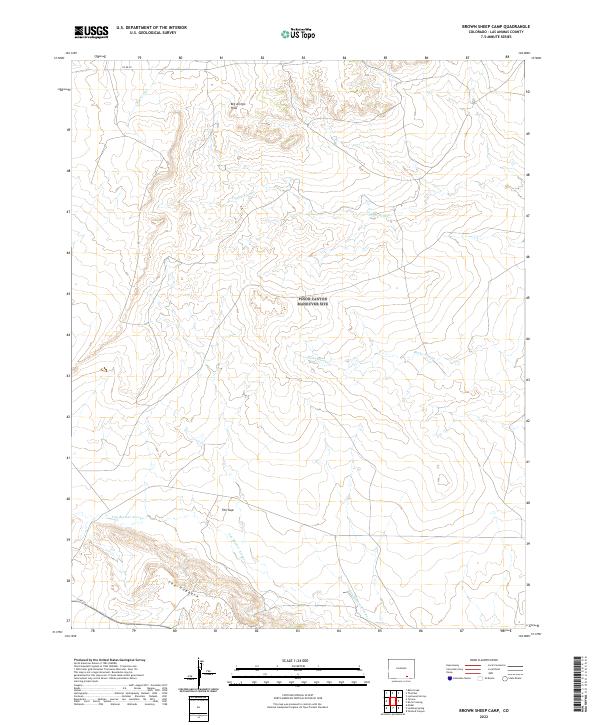
2022 Brown Sheep Camp
Las Animas County, CO

2022 Buck Canyon
Las Animas County, CO
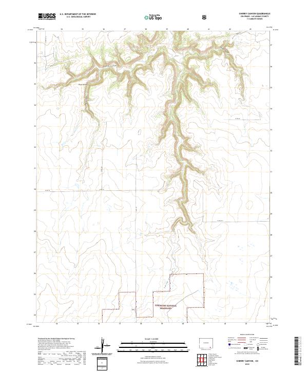
2022 Cherry Canyon
Las Animas County, CO
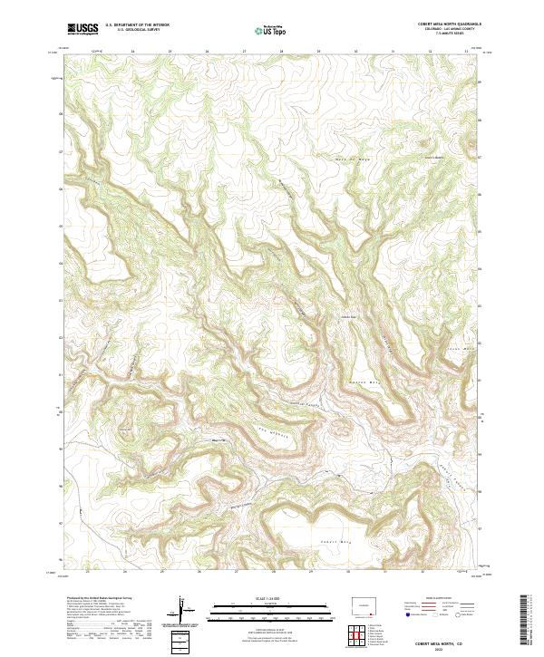
2022 Cobert Mesa North
Las Animas County, CO
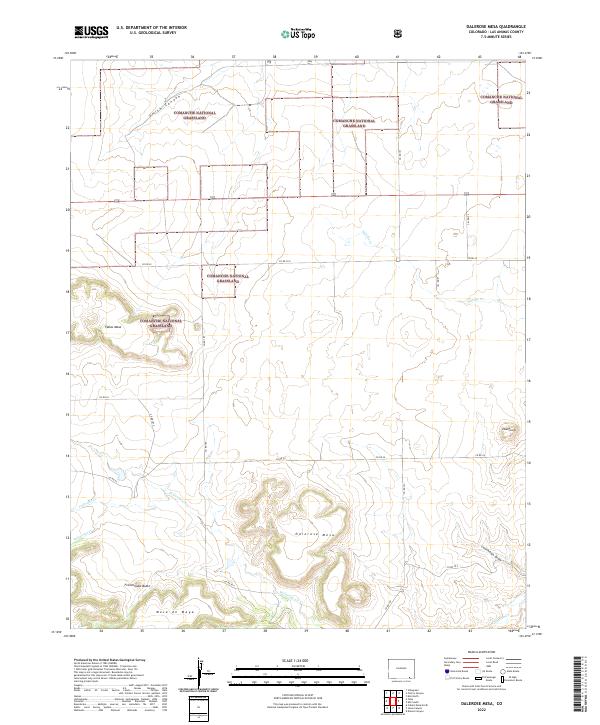
2022 Dalerose Mesa
Las Animas County, CO
2022 Delagua
Las Animas County, CO
2022 Delhi
Las Animas County, CO
2022 Dennis Canyon
Las Animas County, CO
2022 Doss Canyon North
Las Animas County, CO
2022 Doss Canyon South
Las Animas County, CO
2022 Earl
Las Animas County, CO

2022 Fishers Peak
Las Animas County, CO
2022 Furnish Canyon West
Las Animas County, CO
2022 Gulnare
Las Animas County, CO
2022 Herlick Canyon
Las Animas County, CO
2022 Hidden Valley Ranch
Las Animas County, CO
2022 Humbar Spring
Las Animas County, CO
2022 Icehouse Canyon
Las Animas County, CO
2022 Jesus Canyon
Las Animas County, CO
2022 Johnson Canyon
Las Animas County, CO
2022 Jones Lake Spring
Las Animas County, CO
2022 Kim North
Las Animas County, CO
2022 Kim South
Las Animas County, CO
2022 Lambing Spring
Las Animas County, CO
2022 Little Dome
Las Animas County, CO
2022 Little Pine Canyon
Las Animas County, CO
2022 Lockwood Arroyo
Las Animas County, CO
2022 Lost Canyon
Las Animas County, CO
2022 Ludlow
Las Animas County, CO
2022 Madrid
Las Animas County, CO
2022 Miners Peak
Las Animas County, CO
2022 Model
Las Animas County, CO
2022 Mooney Hills
Las Animas County, CO
2022 O V Mesa
Las Animas County, CO
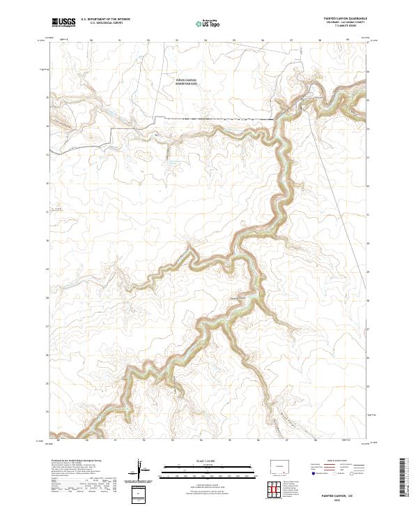
2022 Painted Canyon
Las Animas County, CO
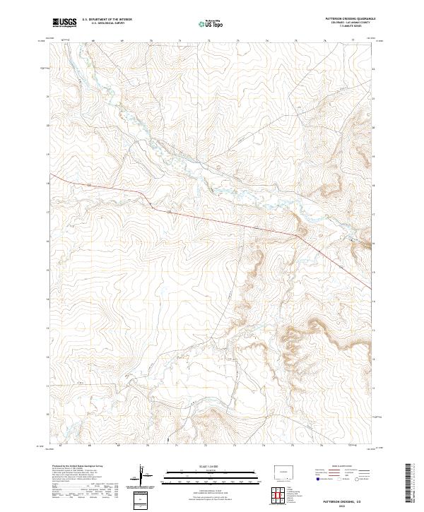
2022 Patterson Crossing
Las Animas County, CO
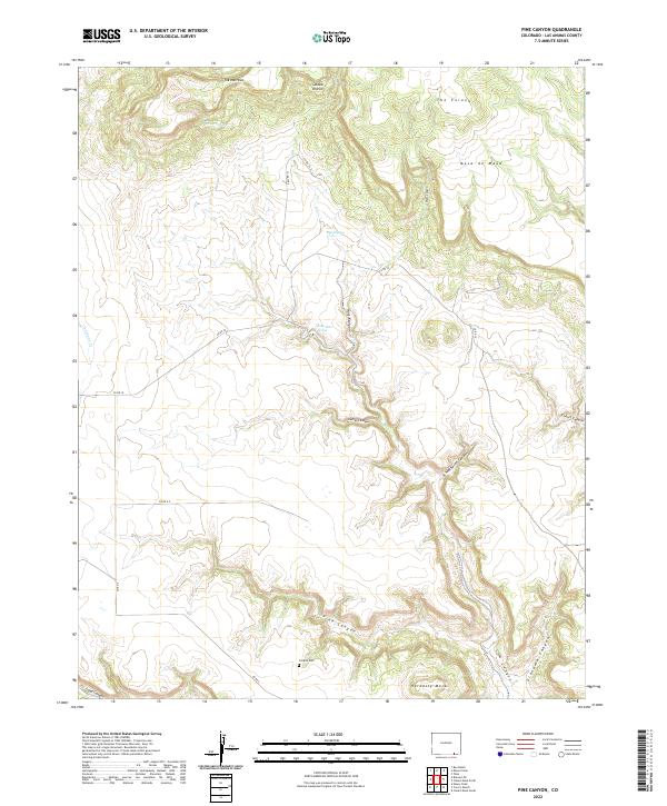
2022 Pine Canyon
Las Animas County, CO
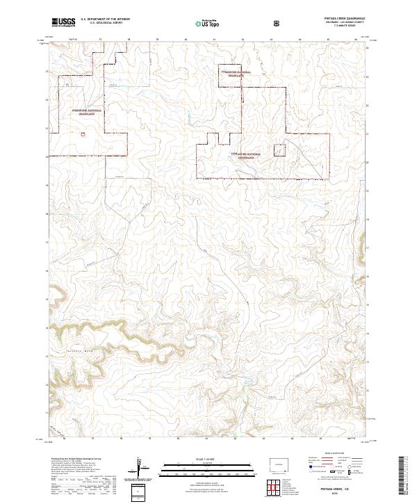
2022 Pintada Creek
Las Animas County, CO
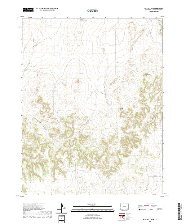
2022 Plug Hat Ranch
Las Animas County, CO
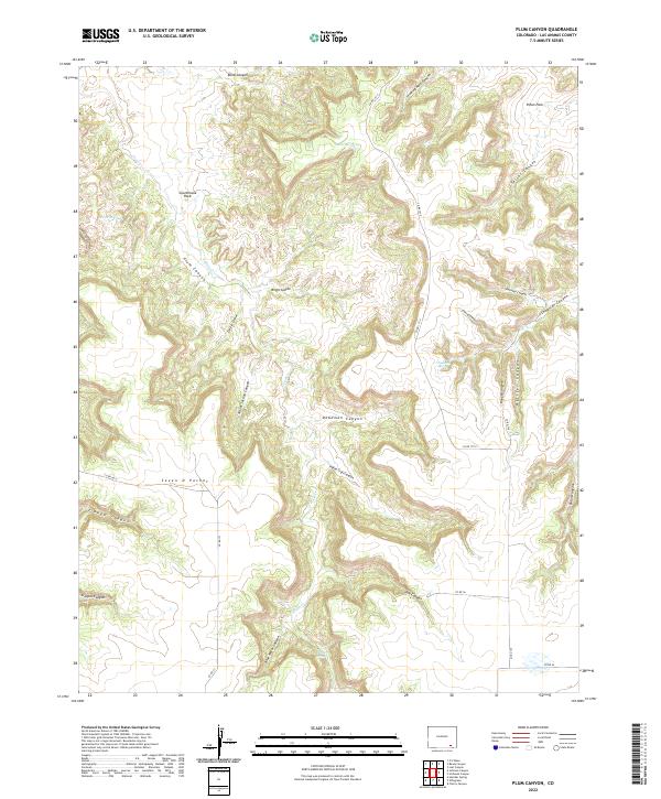
2022 Plum Canyon
Las Animas County, CO
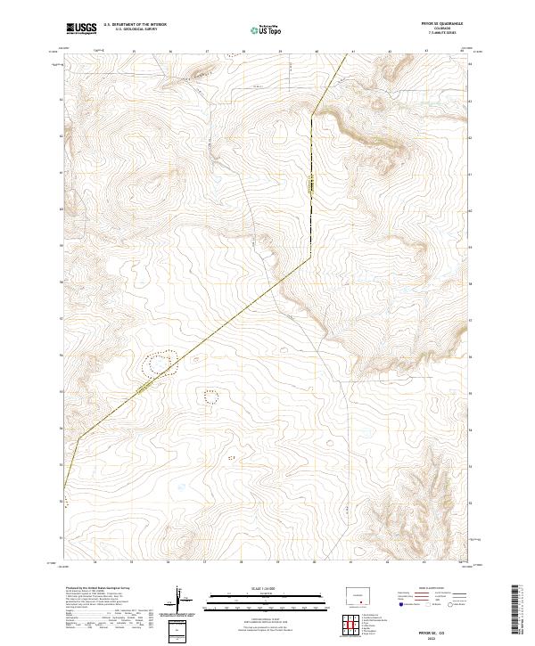
2022 Pryor SE
Las Animas County, CO
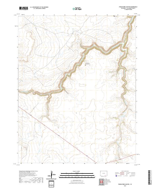
2022 Purgatoire Canyon
Las Animas County, CO
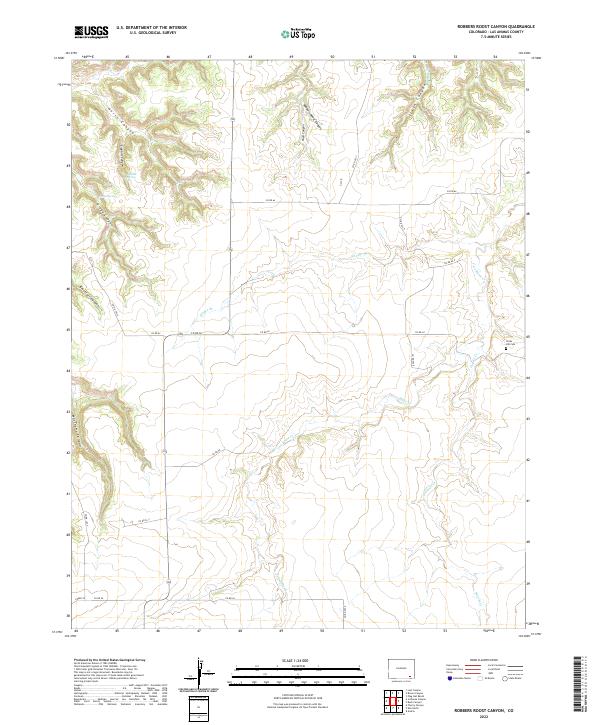
2022 Robbers Roost Canyon
Las Animas County, CO
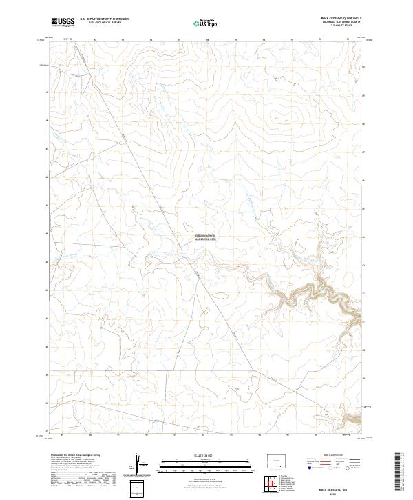
2022 Rock Crossing
Las Animas County, CO
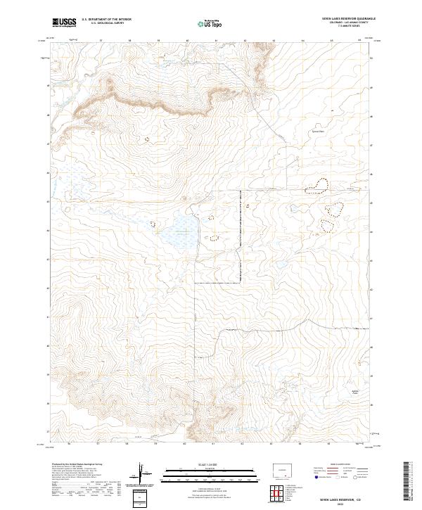
2022 Seven Lakes Reservoir
Las Animas County, CO
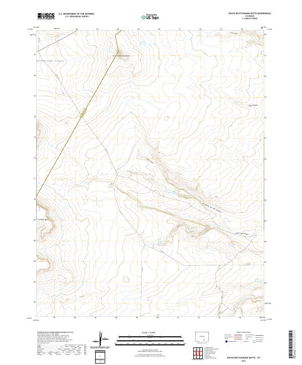
2022 South Rattlesnake Butte
Las Animas County, CO
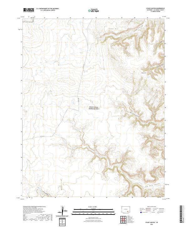
2022 Stage Canyon
Las Animas County, CO
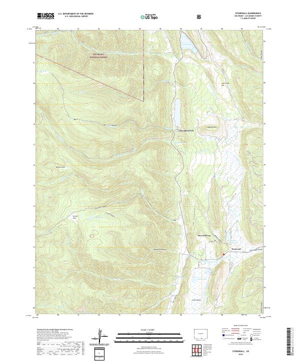
2022 Stonewall
Las Animas County, CO
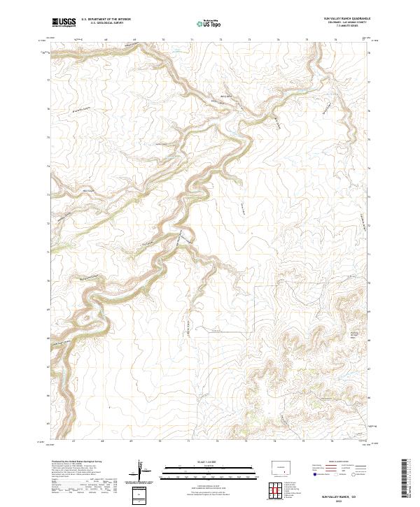
2022 Sun Valley Ranch
Las Animas County, CO
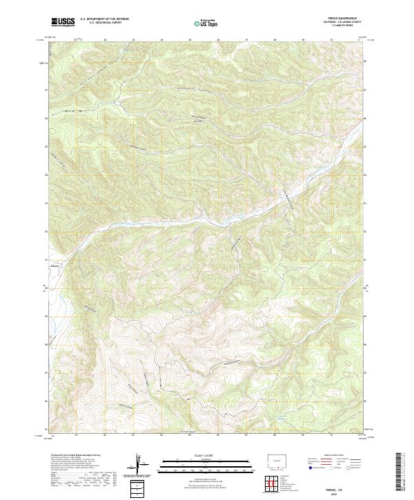
2022 Tercio
Las Animas County, CO
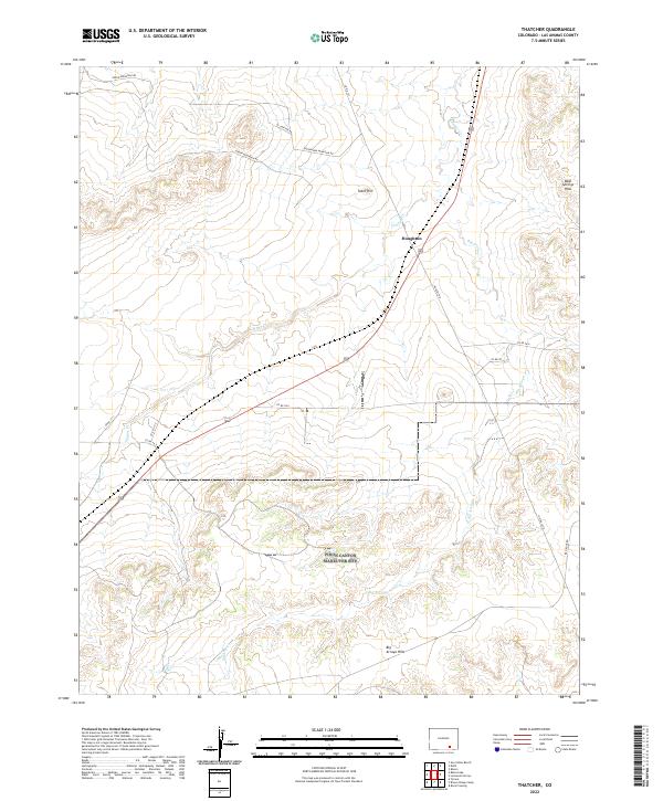
2022 Thatcher
Las Animas County, CO
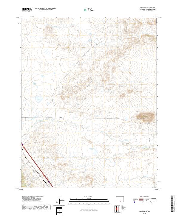
2022 The Hogback
Las Animas County, CO
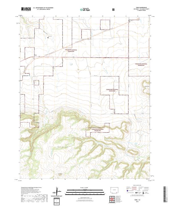
2022 Tobe
Las Animas County, CO
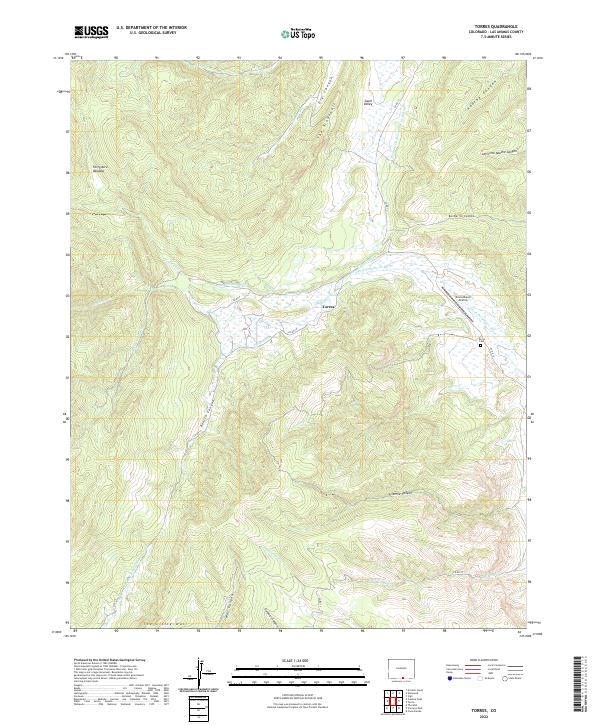
2022 Torres
Las Animas County, CO
2022 Trementina Canyon
Las Animas County, CO
2022 Trinchera
Las Animas County, CO
2022 Trinidad East
Las Animas County, CO
2022 Trinidad West
Las Animas County, CO
2022 Tyrone
Las Animas County, CO
2022 Vega Corral
Las Animas County, CO
2022 Vigil
Las Animas County, CO
2022 Villegreen
Las Animas County, CO