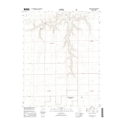
2016 Map of Cherry Canyon
USGS Topo · Published 2016About this map
Comanche National Grassland encompasses a large portion of this high plains landscape in southern Colorado, defined by a network of seasonal drainages and rugged landforms. The topography is dominated by several significant erosion features, including the eponymous Cherry Canyon and the neighboring Soldier Canyon to the east. These landforms cut deep into the plateau, creating sheltered areas like Plum Valley and Snake Canyon that offer a distinct contrast to the surrounding open range.
Find a feature on this map
18 named features on this map. Tap any name to fly to it.
Don’t see what you’re looking for? This feature index may not catch every label — zoom into the map to look around manually.
Map Details
Editions of this 2016 Cherry Canyon Map
This is the sole edition of this map. No revisions or reprints were ever made.
Other maps of this area

1891 · Mesa De Maya
USGS Topo · 1:125,000

1892 · Mt Carrizo
USGS Topo · 1:125,000

1893 · Mesa de Maya
USGS Topo · 1:125,000

1955 · La Junta
USGS Topo · 1:250,000

1958 · La Junta
USGS Topo · 1:250,000

1968 · La Junta
USGS Topo · 1:250,000

1972 · Plum Canyon
USGS Topo · 1:24,000

1972 · Tobe
USGS Topo · 1:24,000
1972 · Villegreen
USGS Topo · 1:24,000
1978 · Dalerose Mesa
USGS Topo · 1:24,000