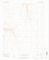
1972 Map of Villegreen
USGS Topo · Published 1975About this map
Villegreen stands as the primary point of settlement in this high plains region of Las Animas County, positioned along the north-south artery of Villegreen Road. The landscape is defined by its drainage systems and plateau breaks, particularly the deep incisions of Plum Canyon and Poitrey Canyon which channel water into Plum Creek and Poitrey Creek. The terrain reveals a sparse but functional ranching environment, indicated by numerous Springs and a Well located near the head of Poitrey Canyon Creek.
Find a feature on this map
18 named features on this map. Tap any name to fly to it.
Don’t see what you’re looking for? This feature index may not catch every label — zoom into the map to look around manually.
Map Details
Editions of this 1972 Villegreen Map
4 editions found
Other maps of this area

1891 · Mesa De Maya
USGS Topo · 1:125,000

1892 · Mt Carrizo
USGS Topo · 1:125,000

1893 · Mesa de Maya
USGS Topo · 1:125,000

1955 · La Junta
USGS Topo · 1:250,000

1958 · La Junta
USGS Topo · 1:250,000

1968 · La Junta
USGS Topo · 1:250,000

1972 · Johnson Canyon
USGS Topo · 1:24,000

1972 · Miners Peak
USGS Topo · 1:24,000

1972 · Plum Canyon
USGS Topo · 1:24,000

1972 · Tobe
USGS Topo · 1:24,000