
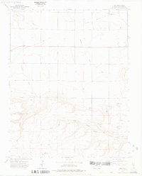
1972 Map of Tobe
USGS Topo · Published 1975About this map
Santa Fe Trail routes cut across this high plains landscape in southern Colorado, marking a corridor of deep historical transit through Las Animas County. The small settlement of Tobe serves as a central point in an area defined by its drainages and livestock infrastructure. Water access, critical in this arid environment, is meticulously documented through features like Williams Windmill and Rincon Windmill, alongside several springs including Fallas Spring and Little Colorado Spring.
Find a feature on this map
23 named features on this map. Tap any name to fly to it.
Don’t see what you’re looking for? This feature index may not catch every label — zoom into the map to look around manually.
Map Details
Editions of this 1972 Tobe Map
2 editions found
Other maps of this area

1891 · Mesa De Maya
USGS Topo · 1:125,000

1892 · Mt Carrizo
USGS Topo · 1:125,000

1893 · Mesa de Maya
USGS Topo · 1:125,000

1955 · La Junta
USGS Topo · 1:250,000

1958 · La Junta
USGS Topo · 1:250,000

1968 · La Junta
USGS Topo · 1:250,000
1972 · Cobert Mesa North
USGS Topo · 1:24,000

1972 · Miners Peak
USGS Topo · 1:24,000
1972 · Villegreen
USGS Topo · 1:24,000
1972 · Humbar Spring
USGS Topo · 1:24,000