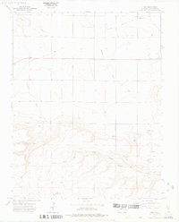
1972 Map of Tobe
USGS Topo · Published 1975About this map
The Santa Fe Trail cuts across the northern reaches of this Las Animas County landscape, following a route through Humbar Canyon and past the Parker Cem. This arid section of southeastern Colorado in the early 1970s is defined by its water management and grazing infrastructure, evidenced by named features like the Williams Windmill, Rincon Windmill, and George Canyon Windmill. The settlement of Tobe serves as a central point in a terrain marked by deep drainages like West Carrizo Creek and Poitrey Creek. Local genealogy is anchored by the Plum Valley Cem and family-named landmarks such as Fallas Mesa and Fallas Spring. The map reveals a network of primitive transportation including a Jeep Trail winding through the southern canyons, connecting remote wells and springs across the high plains environment.
Find a feature on this map
25 named features on this map. Tap any name to fly to it.
Don’t see what you’re looking for? This feature index may not catch every label — zoom into the map to look around manually.
Map Details
Editions of this 1972 Tobe Map
2 editions found
Other maps of this area

1891 · Mesa De Maya
USGS Topo · 1:125,000

1892 · Mt Carrizo
USGS Topo · 1:125,000

1893 · Mesa de Maya
USGS Topo · 1:125,000

1955 · La Junta
USGS Topo · 1:250,000

1958 · La Junta
USGS Topo · 1:250,000

1968 · La Junta
USGS Topo · 1:250,000
1972 · Cobert Mesa North
USGS Topo · 1:24,000

1972 · Miners Peak
USGS Topo · 1:24,000

1972 · Tobe
USGS Topo · 1:24,000
1972 · Villegreen
USGS Topo · 1:24,000