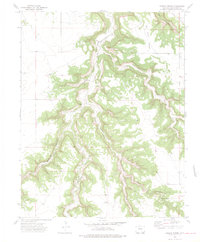
1972 Map of Humbar Spring
USGS Topo · Published 1975About this map
Chacuaco Canyon and Poitrey Canyon dominate this Las Animas County landscape, where water and topography dictated the sparse footprint of human activity in the early 1970s. The intricate network of drainage, including Tobe Creek and Bachicha Creek, reveals how natural corridors shaped movement through the canyonlands. Evidence of remote ranching or seasonal habitation appears at Linder Camp, while the namesake Humbar Spring serves as a vital water source in this arid terrain. A solitary Grave located near Humbar Canyon provides a poignant connection to the individuals who lived in this isolated region. The presence of several Jeep Trails and distinct landmarks like Heart Rock underscores the difficulty of the terrain, where named features like Bar Four Pocket and Seven D Pocket likely reflect early land use or grazing boundaries.
Find a feature on this map
19 named features on this map. Tap any name to fly to it.
Don’t see what you’re looking for? This feature index may not catch every label — zoom into the map to look around manually.
Map Details
Editions of this 1972 Humbar Spring Map
4 editions found
Other maps of this area

1891 · Mesa De Maya
USGS Topo · 1:125,000

1893 · Mesa de Maya
USGS Topo · 1:125,000

1955 · La Junta
USGS Topo · 1:250,000

1958 · La Junta
USGS Topo · 1:250,000

1968 · La Junta
USGS Topo · 1:250,000

1972 · Johnson Canyon
USGS Topo · 1:24,000

1972 · Doss Canyon North
USGS Topo · 1:24,000

1972 · Miners Peak
USGS Topo · 1:24,000

1972 · Plum Canyon
USGS Topo · 1:24,000

1972 · Tobe
USGS Topo · 1:24,000