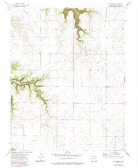
1972 Map of Villegreen
USGS Topo · Published 1985About this map
Villegreen stands as the primary namesake settlement on this Colorado landscape, situated along the north-south artery of Villegreen Road. The geography is defined by deep incisions through the high plains, most notably the winding paths of Plum Canyon and Poitrey Canyon. These drainages, along with their associated waterways like Plum Creek and Poitrey Creek, reveal a terrain sculpted by erosion, creating distinct landmarks like the Seven Pocket formation in the northwest.
Find a feature on this map
13 named features on this map. Tap any name to fly to it.
Don’t see what you’re looking for? This feature index may not catch every label — zoom into the map to look around manually.
Map Details
Editions of this 1972 Villegreen Map
4 editions found
Other maps of this area

1891 · Mesa De Maya
USGS Topo · 1:125,000

1892 · Mt Carrizo
USGS Topo · 1:125,000

1893 · Mesa de Maya
USGS Topo · 1:125,000

1955 · La Junta
USGS Topo · 1:250,000

1958 · La Junta
USGS Topo · 1:250,000

1968 · La Junta
USGS Topo · 1:250,000

1972 · Johnson Canyon
USGS Topo · 1:24,000

1972 · Miners Peak
USGS Topo · 1:24,000

1972 · Plum Canyon
USGS Topo · 1:24,000

1972 · Tobe
USGS Topo · 1:24,000