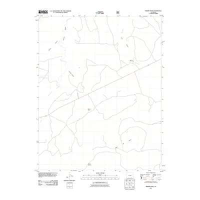
2011 Map of Miners Peak
USGS Topo · Published 2011About this map
Miners Peak rises from a landscape defined by dramatic geological formations and remote ranchland in southeastern Colorado. The map reveals a drainage system where Chacuaco Creek and Tobe Creek have carved deep paths, including Chacuaco Canyon and Tobe Canyon, into the high plains. This area is dominated by the expansive Mesa De Maya, a significant landform that stretches across the southern portion of the sheet. Human presence is sparse, centered on the Mesa De Maya Ranch and the winding path of County Rd 157.9. To the south, the Salazar Rincon provides a notable break in the terrain, illustrating the complex erosion patterns that characterize this high-altitude environment. The map captures a moment of modern ranching life within a geography that remains largely dictated by its canyons and mesas.
Find a feature on this map
10 named features on this map. Tap any name to fly to it.
Don’t see what you’re looking for? This feature index may not catch every label — zoom into the map to look around manually.
Map Details
Editions of this 2011 Miners Peak Map
This is the sole edition of this map. No revisions or reprints were ever made.
Other maps of this area

1891 · Mesa De Maya
USGS Topo · 1:125,000

1893 · Mesa de Maya
USGS Topo · 1:125,000

1955 · La Junta
USGS Topo · 1:250,000

1958 · La Junta
USGS Topo · 1:250,000

1968 · La Junta
USGS Topo · 1:250,000
1972 · Branson SE
USGS Topo · 1:24,000
1972 · Cobert Mesa North
USGS Topo · 1:24,000

1972 · Miners Peak
USGS Topo · 1:24,000

1972 · Tobe
USGS Topo · 1:24,000

1972 · Doss Canyon South
USGS Topo · 1:24,000