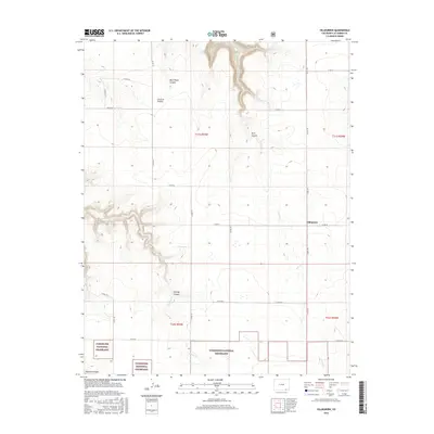
2016 Map of Villegreen
USGS Topo · Published 2016About this map
Villegreen sits at the center of this 2016 survey, a settlement defined by the high plains of southern Colorado. The landscape is deeply incised by a series of drainages, most notably Plum Canyon and the winding course of Plum Cr, which carve through the terrain. To the west, the topography transitions into the protected expanses of the Comanche National Grassland, where Poitrey Canyon and its associated Poitrey Cr dominate the local hydrology. This modern topographic record captures the area's transition from open range to designated federal grassland. Distinctive landmarks such as Seven D Pocket and Blue Water Canyon indicate a history of ranching and natural water sources critical to this arid environment. The map provides a precise layout of the county road network, including Co RD 179 and Co RD 50, which connect these isolated canyonlands.
Find a feature on this map
28 named features on this map. Tap any name to fly to it.
Don’t see what you’re looking for? This feature index may not catch every label — zoom into the map to look around manually.
Map Details
Editions of this 2016 Villegreen Map
This is the sole edition of this map. No revisions or reprints were ever made.
Other maps of this area

1891 · Mesa De Maya
USGS Topo · 1:125,000

1892 · Mt Carrizo
USGS Topo · 1:125,000

1893 · Mesa de Maya
USGS Topo · 1:125,000

1955 · La Junta
USGS Topo · 1:250,000

1958 · La Junta
USGS Topo · 1:250,000

1968 · La Junta
USGS Topo · 1:250,000

1972 · Johnson Canyon
USGS Topo · 1:24,000

1972 · Miners Peak
USGS Topo · 1:24,000

1972 · Plum Canyon
USGS Topo · 1:24,000

1972 · Tobe
USGS Topo · 1:24,000