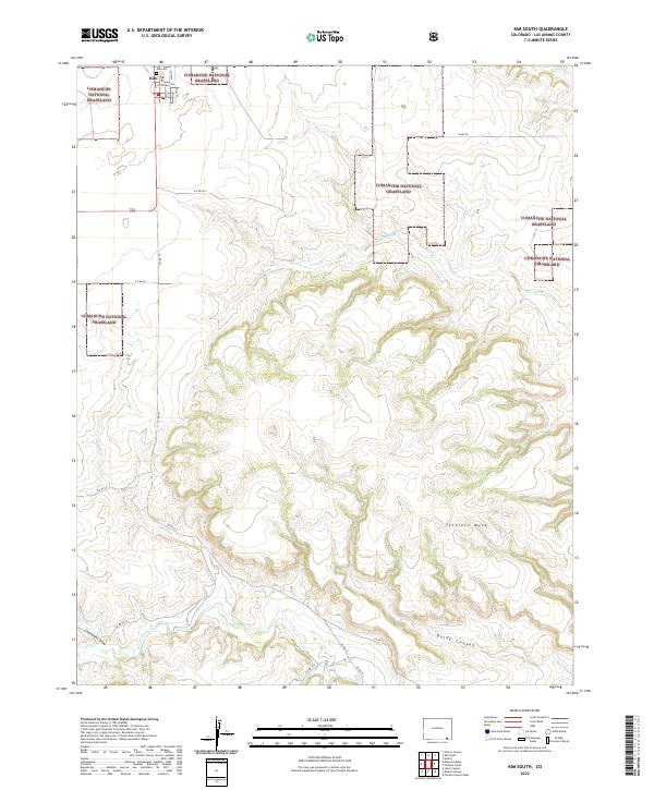
2022 Map of Kim South
USGS Topo · Published 2022About this map
Kim stands at the northern edge of this high plains landscape, serving as a primary point of settlement within the expansive Comanche National Grassland. The terrain is characterized by a series of dramatic erosional features that break the tableland, most notably the prominent Tecolote Mesa and the deep incisions of Baldy Canyon. These landforms dictate the local drainage patterns, with seasonal waterways like Tecolate Cr and W Carrizo Cr carving through the grassland.
Find a feature on this map
24 named features on this map. Tap any name to fly to it.
Don’t see what you’re looking for? This feature index may not catch every label — zoom into the map to look around manually.
Map Details
Editions of this 2022 Kim South Map
This is the sole edition of this map. No revisions or reprints were ever made.
Other maps of this area

1892 · Mt Carrizo
USGS Topo · 1:125,000

1955 · La Junta
USGS Topo · 1:250,000

1958 · La Junta
USGS Topo · 1:250,000

1968 · La Junta
USGS Topo · 1:250,000
1978 · Dalerose Mesa
USGS Topo · 1:24,000

1978 · Pintada Creek
USGS Topo · 1:24,000
1978 · Furnish Canyon West
USGS Topo · 1:24,000
1978 · Cherry Canyon
USGS Topo · 1:24,000
1978 · Jesus Canyon
USGS Topo · 1:24,000
1978 · Dennis Canyon
USGS Topo · 1:24,000