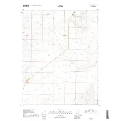
2019 Map of Pryor SE
USGS Topo · Published 2019About this map
The Hogback rises as a prominent geographic landmark in this high-altitude landscape along the border of Las Animas and Huerfano counties. The terrain is defined by its drainage patterns, most notably the winding path of Tejana Arroyo in the northeast. This 2019 survey documents a sparsely populated region primarily accessed by a network of county roads, including Co Rd 61 and Co Rd 211, which navigate the various ridges and drainages. The map provides a clear look at the township and range divisions, showing the junction of T28S and T29S across ranges R63W, R64W, and R65W. While modern in its production, it captures a landscape where the primary human footprint remains the road system and the historic county lines that bisect the high Colorado plains.
Find a feature on this map
14 named features on this map. Tap any name to fly to it.
Don’t see what you’re looking for? This feature index may not catch every label — zoom into the map to look around manually.
Map Details
Editions of this 2019 Pryor SE Map
This is the sole edition of this map. No revisions or reprints were ever made.
Other maps of this area

1891 · Walsenburg
USGS Topo · 1:125,000

1891 · Spanish Peaks
USGS Topo · 1:125,000

1891 · Apishapa
USGS Topo · 1:125,000

1892 · Elmoro
USGS Topo · 1:125,000

1893 · Spanish Peaks
USGS Topo · 1:125,000

1893 · Apishapa
USGS Topo · 1:125,000

1893 · Elmoro
USGS Topo · 1:125,000

1894 · Walsenburg
USGS Topo · 1:125,000

1895 · Spanish Peaks
USGS Topo · 1:125,000

1897 · Walsenburg
USGS Topo · 1:125,000