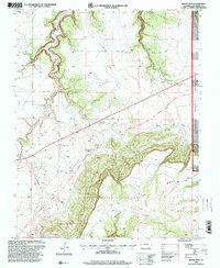
1996 Map of Miners Peak
USGS Topo · Published 2000About this map
The Santa Fe National Historic Trail cuts a prominent line across this high plains landscape, following the Granada Fort Union Route through the southeastern Colorado territory. This 1996 revision, published by the U.S. Geological Survey and USDA Forest Service, details a region where deep drainages like Chacuaco Canyon and the Salazar Rincon give way to the prominent plateau of Maya Mesa.
Find a feature on this map
13 named features on this map. Tap any name to fly to it.
Don’t see what you’re looking for? This feature index may not catch every label — zoom into the map to look around manually.
Map Details
Editions of this 1996 Miners Peak Map
This is the sole edition of this map. No revisions or reprints were ever made.
Other maps of this area

1891 · Mesa De Maya
USGS Topo · 1:125,000

1893 · Mesa de Maya
USGS Topo · 1:125,000

1955 · La Junta
USGS Topo · 1:250,000

1958 · La Junta
USGS Topo · 1:250,000

1968 · La Junta
USGS Topo · 1:250,000
1972 · Branson SE
USGS Topo · 1:24,000
1972 · Cobert Mesa North
USGS Topo · 1:24,000

1972 · Miners Peak
USGS Topo · 1:24,000

1972 · Tobe
USGS Topo · 1:24,000

1972 · Doss Canyon South
USGS Topo · 1:24,000