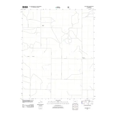
2011 Map of Villegreen
USGS Topo · Published 2011About this map
Villegreen occupies a high-plains landscape in Las Animas County, defined by a sparse network of county roads that crisscross the southeastern Colorado ranching country. The map captures the subtle but distinctive geography of the region, including the depression of Seven D Pocket and the descent into Poitrey Canyon. Seasonal drainage systems like Plum Creek and Poitrey Creek snake across the quadrangle, illustrating the importance of water flow in this arid environment. The layout of rural routes such as County Rd-179 and County Rd-44 suggests a long-standing pattern of land division and remote habitation, where the vast distances between homesteads and the settlement at Villegreen are bridged by a strictly grid-based road system typical of the Western plains.
Find a feature on this map
20 named features on this map. Tap any name to fly to it.
Don’t see what you’re looking for? This feature index may not catch every label — zoom into the map to look around manually.
Map Details
Editions of this 2011 Villegreen Map
This is the sole edition of this map. No revisions or reprints were ever made.
Other maps of this area

1891 · Mesa De Maya
USGS Topo · 1:125,000

1892 · Mt Carrizo
USGS Topo · 1:125,000

1893 · Mesa de Maya
USGS Topo · 1:125,000

1955 · La Junta
USGS Topo · 1:250,000

1958 · La Junta
USGS Topo · 1:250,000

1968 · La Junta
USGS Topo · 1:250,000

1972 · Johnson Canyon
USGS Topo · 1:24,000

1972 · Miners Peak
USGS Topo · 1:24,000

1972 · Plum Canyon
USGS Topo · 1:24,000

1972 · Tobe
USGS Topo · 1:24,000