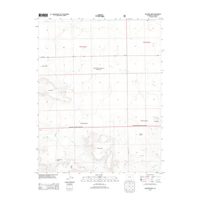
2013 Map of Dalerose Mesa
USGS Topo · Published 2013About this map
Comanche National Grassland dominates this portion of southeastern Las Animas County, where the high plains of Colorado meet a complex system of mesas and draws. The southern half of the sheet is defined by the significant elevation of Mesa de Maya and the sprawling Dalerose Mesa, separated by the drainage of W Carrizo Cr. These geological features represent a transition from the flatter grasslands to the north, which are bisected by Us HWY 160 and intermittent streams like Saltillo Cr.
Find a feature on this map
21 named features on this map. Tap any name to fly to it.
Don’t see what you’re looking for? This feature index may not catch every label — zoom into the map to look around manually.
Map Details
Editions of this 2013 Dalerose Mesa Map
This is the sole edition of this map. No revisions or reprints were ever made.
Other maps of this area

1891 · Mesa De Maya
USGS Topo · 1:125,000

1892 · Mt Carrizo
USGS Topo · 1:125,000

1893 · Mesa de Maya
USGS Topo · 1:125,000

1955 · La Junta
USGS Topo · 1:250,000

1958 · La Junta
USGS Topo · 1:250,000

1968 · La Junta
USGS Topo · 1:250,000
1972 · Cobert Mesa North
USGS Topo · 1:24,000

1972 · Tobe
USGS Topo · 1:24,000
1972 · Villegreen
USGS Topo · 1:24,000
1978 · Dalerose Mesa
USGS Topo · 1:24,000